
Municipality Tianjin Elevation 7 m (23 ft) Area 40.64 km² | Township-level divisions 12 subdistricts Time zone China Standard (UTC+8) Local time Monday 11:42 PM | |
 | ||
Country People's Republic of China Tianjin district map Subdivisions of Tianjin
1
2
3
4
5
6
7
8
9
10
11
12
13
14
15
16
Core districts
See inset
1
Heping
2
Hedong
3
Hexi
4
Nankai
5
Hebei
6
Hongqiao
Suburbs
7
Dongli
8
Xiqing
9
Jinnan
10
Beichen
Binhai and Rural
13
Binhai
14
Ninghe
11
Wuqing
15
Jinghai
12
Baodi
16
Ji Zhou Weather 7°C, Wind SW at 6 km/h, 59% Humidity Colleges and Universities Nankai University, Tianjin University, Tianjin University of Traditio, Tianjin University of Techno | ||
Nankai District (simplified Chinese: 南开区; traditional Chinese: 南開區; pinyin: Nánkāi Qū) is a district of Tianjin, People's Republic of China. Nankai District borders the Hai River in the east and Chentangzhuang Railway in the west and south.
Contents
- Map of Nankai Tianjin China
- History
- Administrative divisions
- Geography
- Demographics
- Metro
- Education
- Parks
- References
Map of Nankai, Tianjin, China
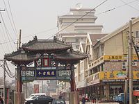
A number of important Tianjin landmarks lie in the district including the Tianjin Museum, Tianjin Radio and Television Tower, Tianjin Water Park, Tianjin Zoo and Tianjin Olympic Center Stadium. Nankai is also home to the city's most prestigious educational institutions including Tianjin University and Nankai University. The Tianjin New Technology Industrial Area, a 12 square km precinct, is also located in Nankai.
History
Historically, northern parts of Nankai District were located inside ancient Tianjin. The Tianfei Palace or Palace of the Queen of Heaven of the Yuan Dynasty was built in north-eastern Nankai in the year 1326. In the Ming Dynasty, the heart of the city of Tianjin was set up in Nankai. Nankai became part of the military garrisons during the Ming and Qing Dynasties and the city wall served as a major defense system against foreign invasion in the late 19th century.
Administrative divisions
There are 12 subdistricts in the district:
Geography
Nankai District is located in the south-west corner of the urban Tianjin, bordered by Hongqiao District to the north, Hebei and Heping Districts to the north-east, Hexi District to the east and Xiqing District to the south-west. It occupies an area of 40.64 square kilometres (15.69 sq mi). The natural topography is characterised by higher elevation in the north of the district and a lower elevation in the south, with the average altitude being 3 metres.
Demographics
Nankai District has been one of the fastest growing districts in Tianjin since the formation of the People's Republic of China. The population was 220,000 in 1949. In 2006, the population was 925,000 and the density was 19621/km2 (50818/sq. mi.).
The rate of population growth has been negative since 1993 with the birth rate averaging 3.97% and death rate registering 4.56% in 2005.
The majority of people in Nankai District are Han Chinese. Small populations of ethnic minorities such as the Hui, Manchu and Mongol peoples also exist.
Metro
Nankai is currently served by three metro lines operated by Tianjin Metro:
Education
Universities
Parks
Tianjin Zoo (天津动物园)
Tianjin Water Park (天津水上公园)
Changhong Park (长虹公园)