
Local time Monday 7:38 PM | ||
 | ||
Weather 23°C, Wind NW at 11 km/h, 40% Humidity | ||
Go to nandwal through map
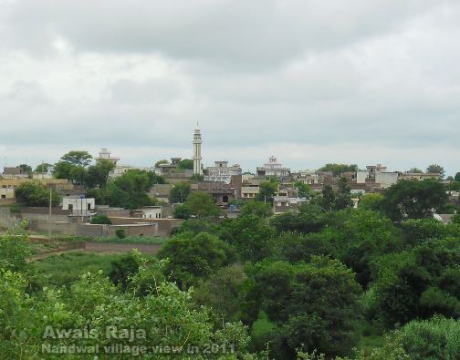
Nandwal is a village in Pakistan near Kotla Arab Ali Khan and the foothills of the Himalayas, located near the northern edge of Pakistan. It is a small village of some 400 houses, surrounded by tall trees. The village is related with the district Gujrat tehsil Kharian. It is approximately 45 kilometers from Gujrat District, and 7 kilometers from Kotla Arab Ali Khan. And other side present a place of Azad Kashmir Kot Jattan only on 1 km away from Nandwal village
Contents
Map of Nandwal, Pakistan
Nandwal consists of three areas:
Nearby villages
The nearest villages are Machhora, Singla, Sarsala, Dhandar kot, Sedo Langar, Chiryawala, Khair Katto, Battian, Hasan Pathan, Achh, Gochh, Kotla Arab Ali Khan, Kotla, Sadwal, Rangpur, Dalawrabad, Rathori, Kakrali, Rolia , Samrala.
Schools
There are two primary schools, one for boys and one for girls; however, some boys and girls get benefit from both schools, and more are going to Kotla Arab Ali Khan and Dhandar Azad Kashmir which is a popular village of district bhimber. Often peoples of this area gets basic education from dhandar.
Religion
Nandwal is a predominately Muslim village. It has one mosque, called Jameyan masjid nandwal