
Elevation 1,358 m Population 1,433 (2001) | Time zone IST (UTC+5:30) Local time Monday 7:21 PM | |
 | ||
Weather 18°C, Wind E at 2 km/h, 42% Humidity | ||
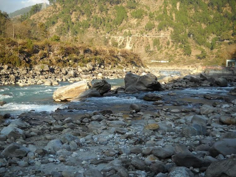
Nandaprayag one of the panch prayag of alaknanda river
Nandaprayag is a town and a nagar panchayat in Chamoli district in the Indian state of Uttarakhand. Nandaprayag is one of the Panch Prayag (five confluences) of Alaknanda River, and lies at the confluence of Alaknanda River and Nandakini River. Nandaprayag was once the capital of Yadu kingdom.
Contents
- Nandaprayag one of the panch prayag of alaknanda river
- Map of Nandaprayag Uttarakhand
- Geography
- Demographics
- Hydro Electric Project
- References
Map of Nandaprayag, Uttarakhand
Geography
Nandaprayag is located at 30.33°N 79.33°E / 30.33; 79.33. It has an average elevation of 1,358 metres (4,455 feet).The 538 km long NH 58, connecting NCR with the holy shrine Badrinath and the Mana pass near Indo-Tibet border, pass through this quaint town. The town is nestled in the mountainous terrain overlooking the confluence or holy "prayag".
Demographics
As of 2001 India census, Nandaprayag had a population of 1433. Males constitute 56% of the population and females 44%. Nandaprayag has an average literacy rate of 70%, higher than the national average of 59.5%: male literacy is 78%, and female literacy is 61%. In Nandaprayag, 13% of the population is under 6 years of age.
Hydro Electric Project
Uttarakhand Jalvidyut UJVN, a government of Uttarakhand enterprise is working on the Bowala Nand Prayag Hydro Electric Power Project. The project with a proposed installation of 300 MW (4 x 75 MW) is envisaged to generate an annual energy generation of 1102 MU in a 90% dependable year.
Salient Features