
Location North Pacific Total islands 51 Population 801 (1998) Area 6.27 km² | Archipelago Ralik Highest elevation 3 m (10 ft) Island group Ralik Chain | |
 | ||
Namu atoll dolphins 2
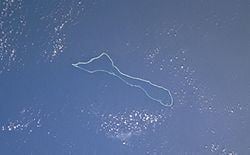
Namu Atoll (Marshallese: Nam̧o, [nʲæ͡ɑmˠɤ͡oo̯]) is a coral atoll of 54 islands in the Pacific Ocean, and forms a legislative district of the Ralik Chain of the Marshall Islands. Its total land area is only 6.27 square kilometres (2.42 sq mi), but that encloses a lagoon of 397 square kilometres (153 sq mi). It is located approximately 62 kilometres (39 mi) south-southwest of Kwajalein Atoll.
Contents
Map of Namu Atoll, RMI
There are four main population centres, the islands of Namu, Majkin, Loen and Mae. The population of Namu Atoll was 801 in 1998.
History
The Spanish expedition of Álvaro de Mendaña made the first recorded sighting by Europeans of Namu Atoll on 17 September 1568. The pilot, Hernán Gallego, mistook it for San Bartolome (Bokak Atoll), which Alonso de Salazar had seen in 1526, although Bokak was a long way to the north. Mendaña says they named them San Mateo Shoals. The islands were inhabited, with many houses. A landing party found a chisel made of a nail and pieces of rope which were presumably gifts left there on 3 July 1566 by the galleon San Jerónimo, then commanded by the rebel pilot Lope Martín.
The Empire of Germany claimed Namu Atoll along with the rest of the Marshall Islands in 1884, and the Germans established a trading post. After World War I, the island came under the South Pacific Mandate of the Empire of Japan. Following the end of World War II, it came under the control of the United States as part of the Trust Territory of the Pacific Islands until 1986 when the Marshall Islands achieved their independence.