
Region Tibet Township-level divisions 12 Time zone China Standard (UTC+8) Area 16,195 km² | Prefecture Nagchu Prefecture County seat Nagqu Town Elevation 4,513 m | |
 | ||
Country People's Republic of China | ||
Horse racing festival in summer nagqu county nagqu
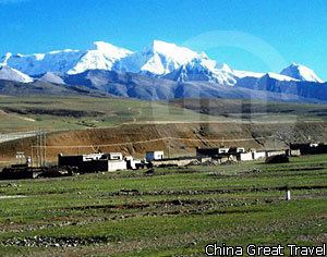
Nagqu County (Tibetan: ནག་ཆུ་རྫོང་།; Chinese: 那曲县; pinyin: Nàqū xiàn) is a county within the Nagqu Prefecture of the Tibet Autonomous Region, western People's Republic of China. The name of the county in the Tibetan language means "black river".
Contents
- Horse racing festival in summer nagqu county nagqu
- Map of Nagqu Tibet China
- Geography and climate
- Administrative divisions
- Transport
- References
Map of Nagqu, Tibet, China
Geography and climate
Located in the northern part of the Tibet Autonomous Region, Nagqu County ranges in latitude from 30° 31' to 31° 55' N and in longitude from 91° 12' to 93° 02' E. Bordering counties within Nagqu Prefecture are Lhari to the southeast, Biru to the east, Nyainrong to the northeast, Amdo to the northwest, and Baingoin to the west, while Lhasa City, the regional capital, is to the south.
With an elevation of around 4,500 metres (14,800 ft), Nagqu has a harsh, alpine climate (Köppen EH), with long, very cold and dry winters, and short, cool summers. In winter, temperatures frequently drop below −20 °C (−4 °F) at night and in summer typically rise to 16 °C (61 °F) during the day. The monthly 24-hour average daily temperature ranges from −12.6 °C (9.3 °F) in January to 9.0 °C (48.2 °F) in July, and the annual mean is only −1.17 °C (29.9 °F). From June to September, a majority of the days receives some precipitation, and over 80% of the annual precipitation is delivered.