
Country Thailand Time zone ICT (UTC+7) Geocode 4602 Population 35,234 (2005) | Seat Na Mon Postal code 46230 Area 245.3 km² Province Kalasin Province | |
 | ||
University Kalasin Rajabhat University | ||
Na Mon (Thai: นามน) is a district (amphoe) in the eastern part of Kalasin Province, northeastern Thailand.
Contents
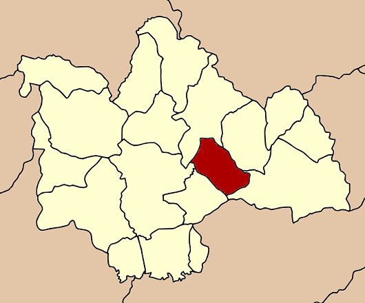
Map of Na Mon District, Kalasin, Thailand
Geography
Neighboring districts are (from the northeast clockwise) Huai Phueng, Kuchinarai, Don Chan, Mueang Kalasin, and Somdet of Kalasin Province.
History
The minor district (king amphoe) Na Mon was created on 20 September 1973, when the three tambon Na Mon, Yot Kaeng, and Song Plueai were split off from Mueang Kalasin district. It was upgraded to a full district on 1 January 1988.
Administration
The district is subdivided into 5 subdistricts (tambon), which are further subdivided into 66 villages (muban). Na Mon is a township (thesaban tambon) which covers parts of the tambon Na Mon. There are further 5 tambon administrative organizations (TAO).
References
Na Mon District Wikipedia(Text) CC BY-SA