
Postcode area N Post towns 1 Postcode sectors 112 | Postcode districts 25 Postcodes (live) 17,546 | |
 | ||
N postcode area
The N (Northern) postcode area, also known as the London N postcode area, is the part of the London post town covering part of North London, England.
Contents
It includes areas in the London boroughs of Hackney, Islington, Camden, Barnet, Haringey and Enfield. The N postcode area does not cover all of the north of Greater London however. For example, parts of the London Borough of Enfield and the London Borough of Barnet are covered by the EN postcode area, and parts of the London Borough of Barnet and the London Borough of Camden are covered by the NW postcode area.
Postal administration
The postcode area originated in 1857 as the N district of London. In 1917 it was subdivided into 22 numbered districts. The Northern head district was designated as N1 and the rest of the numbering followed the alphabetical order of the other districts' main names. Most districts include local areas known by their own specific names (see table below). The official post town for all N postcodes is LONDON; district names do not form an essential part of postal addresses.
To accommodate redevelopment in Kings Cross Central, a new district N1C was created in 2010. The N area also includes two non-geographic postcode districts: N1P for PO boxes in N1 or N1C; and N81 for ballot mailings to Electoral Reform Services in N8.
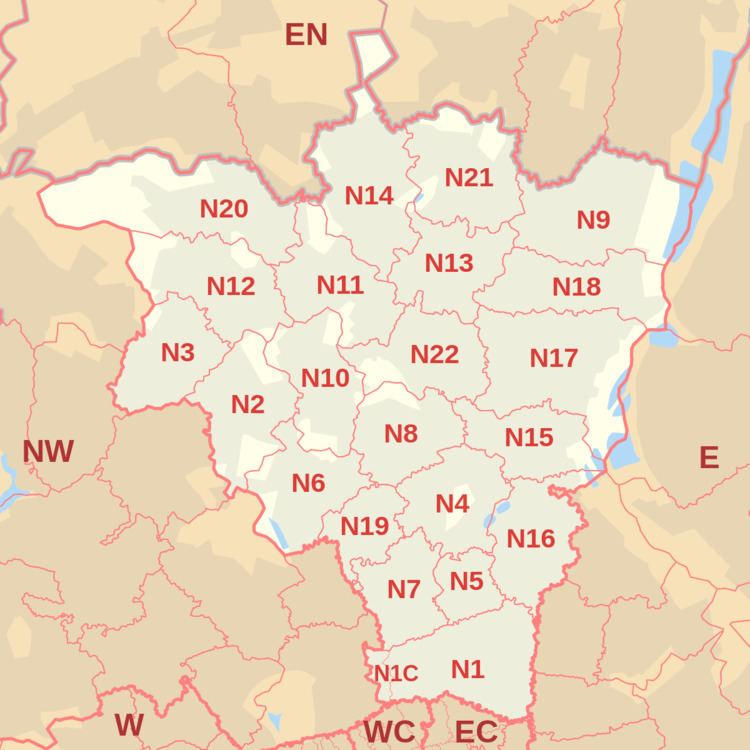
List of postcode districts
The approximate coverage of the postcode districts, with the historic postal district names shown in italics:
Boundaries
Postcode district N1 is central to London, with the N2–N20 postcode districts radiating outwards to the north. The postcode area is roughly bounded by the River Lea to the east and the Inner Ring Road to the south. In the west the boundary cuts through Hampstead Heath and follows the North Circular Road and Dollis Brook for short distances. The northern boundary cuts through several open spaces and follows the A110 road for a short distance. The postcode area maps to the London Borough of Haringey, most of the London Borough of Islington, the northwestern section of the London Borough of Hackney, southeastern parts of the London Borough of Barnet, southern sections of the London Borough of Enfield, and small parts of the London Borough of Camden.