
Country Norway District Namdalen Area rank 95 in Norway Area 1,067 km² Local time Tuesday 1:31 PM | County Nord-Trøndelag Administrative centre Kolvereid Demonym(s) Nærøyværing Population 4,999 (2011) Official language form Bokmål | |
 | ||
Weather 4°C, Wind SE at 18 km/h, 59% Humidity Points of interest Hoflesstranda, Kroken, Marøystranda, Laukvikstranda, Staggavika, Einarstranda | ||
Nærøy is a municipality in Nord-Trøndelag county, Norway. Nærøy is part of the Namdalen region. Norway's smallest town, Kolvereid, is the administration centre of the municipality. Some villages in Nærøy include Abelvær, Foldereid, Gravvik, Lund, Ottersøy, Salsbruket, Steine, and Torstad.
Contents
- Map of NC3A6rC3B8y Norway
- General information
- Name
- Coat of arms
- Churches
- Geography
- Government
- Municipal council
- Transportation
- References
Map of N%C3%A6r%C3%B8y, Norway
General information
Nærøy was established as a municipality on 1 January 1838 (see formannskapsdistrikt). On 1 July 1869, the western district was separated from Nærøy to become the new municipality of Vikten. This left Nærøy with 1,477 residents. On 1 January 1902, an unpopulated area of Kolvereid was transferred to Nærøy. On 1 January 1964, the municipalities of Gravvik, Kolvereid, and most of Foldereid were merged with Nærøy to form a new, larger municipality of Nærøy. Prior to the merger, Nærøy had 2,182 residents and after the merger there were 6,241 residents.
Name
The Old Norse form of the name was Njarðøy. The first element is maybe the stem form of the name of the Norse god Njord (but it is suspicious that it is not in the genitive case). The last element is øy which means "island". Historically, the name has had varying spellings such as Nærø or Nærøen.
Coat-of-arms
The coat-of-arms is from modern times; they were granted on 22 May 1987. The arms are based on the seal of King Håkon Magnusson from 1344, on a document in which the King granted several rights to the local farmers. The seal shows the St. Mary in a portal decorated with fleur-de-lis, the symbol of the St. Mary. The arms show a combination of three fleur-de-lis on a gold background. The fleur-de-lis design is red, since the local water lilies generally have a red color.
Churches
The Church of Norway has four parishes (sokn) within the municipality of Nærøy. It is part of the Namdal deanery in the Diocese of Nidaros.
Geography
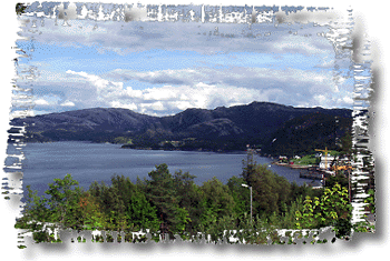
The municipality is located in the northwestern part of Nord-Trøndelag county, along the Foldafjord. It includes the islands of Austra and Gjerdinga and the Kvingra peninsula. Several large lakes are located in the municipality including Mjosundvatnet, Salsvatnet, and Storvatnet.
Government
All municipalities in Norway, including Nærøy, are responsible for primary education (through 10th grade), outpatient health services, senior citizen services, unemployment and other social services, zoning, economic development, and municipal roads. The municipality is governed by a municipal council of elected representatives, which in turn elect a mayor.
Municipal council
The municipal council (Kommunestyre) of Nærøy is made up of 27 representatives that are elected to every four years. Currently, the party breakdown is as follows:
Transportation
Norwegian County Road 17 crosses the northeastern part of the municipality. There is a large network of bridges in the municipality that connect islands and cross fjords. Most notably is the Marøysund Bridge and Nærøysund Bridge which connect Nærøy to Vikna to the west. Also Hestøy Bridge and Smines Bridge connect the village of Lund to Fosnes municipality to the south.