
Listing HuMP OS grid SH315907 Prominence 110 m | Elevation 170 m | |
 | ||
Topo map OS Landranger 114 / Explorer 262 Similar Mynydd Bodafon, Holyhead Mountain, Bera Mawr, Coity Mountain, Parys Mountain | ||
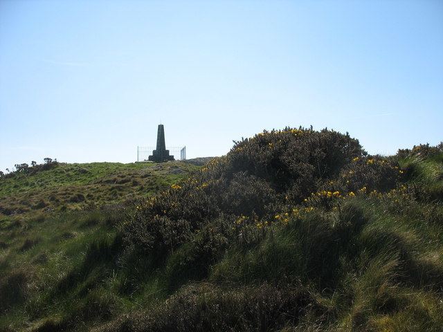
Mynydd y Garn is a hill in the northwest of the Isle of Anglesey in north Wales. Its 170m high summit is crowned by a trig point and a stone obelisk. Erected in 1897 it commemorates Sir William Thomas, ship-owner and one time High Sheriff of Anglesey.
Contents
Map of Mynydd y Garn, Amlwch, UK
GeologyEdit
The summit of the hill is formed from Ordovician sandstone whilst Gwna Group schists outcrop on its southern slopes. To their south are New Harbour Group schists and psammites. Surrounding lower land is mantled by glacial till though the hill itself is free from such superficial deposits.
AccessEdit
The summit area of the hill is owned by the National Trust and thereby open to free public access on foot. A couple of public footpaths run across its western slopes but access to the summit is gained from a minor road to its west by a short permissive path.