
OS grid reference SW804363 Post town FALMOUTH Local time Thursday 6:37 AM | Sovereign state United Kingdom Postcode district TR11 Dialling code 01326 | |
 | ||
Weather 4°C, Wind N at 13 km/h, 88% Humidity | ||
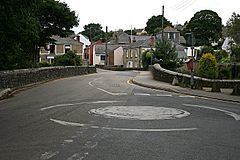
Mylor Bridge(Cornish: Ponsnowyth) is a village in Cornwall, England, United Kingdom. It is in Mylor civil parish at the head of Mylor Creek, about five miles north of Falmouth.
Contents
Map of Mylor Bridge, Falmouth, UK
Found in Mylor Bridge are a Post Office/Newsagents, grocery store, fishmonger, hairdressers, butcher's shop and a public house called the Lemon Arms. The village also has a primary school. The parish church of Saint Mylor is in the nearby village of Mylor Churchtown.
Mylor Bridge lies within the Cornwall Area of Outstanding Natural Beauty (AONB). Almost a third of Cornwall has AONB designation, with the same status and protection as a National Park.
Governance
The village is represented as Penryn East and Mylor on Cornwall Council. It was formerly in the Falmouth and Camborne parliamentary electoral constituency; from 2010 it will be in the Falmouth and Truro constituency. The current Member for Parliament (MP) is Sarah Newton of the Conservative Party (UK). .