
- summer (DST) CEST (UTC+2) Local time Thursday 7:05 AM | Elevation 325 m | |
 | ||
Weather 6°C, Wind E at 10 km/h, 96% Humidity Points of interest Gazdovský dvor, Hrajky, Múzeum Slovenských národnýc, Hrob vojaka Františka | ||
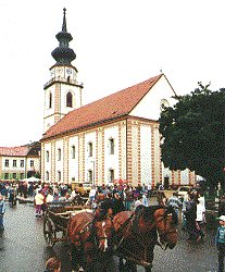
Myjava ([ˈmijaʋa]; historically also Miava, German: Miawa, Hungarian: Miava) is a town in Trenčín Region, Slovakia.
Contents
Map of Myjava, Slovakia
Geography
It is located in the Myjava Hills at the foothills of the White Carpathians and nearby the Little Carpathians. The river Myjava flows through the town. It is 10 km away from the Czech border, 35 km from Skalica and 100km from Bratislava.
History
The settlement was established in 1533 and was colonized by two groups of inhabitants: refugees fleeing from the Ottomans in southern Upper Hungary (present Slovakia) and inhabitants from north-western and northern Upper Hungary. During the Revolutions of 1848, the first Slovak National Council met in the town as a result of the Slovak Uprising. Today, the house of their meeting is now part of the Museum of the Slovak National Councils, a part of the Slovak National Museum network.
Demographics
According to the 2014 census, the town had 12,042 inhabitants. In 2001 95.5% of the inhabitants were Slovaks, 1.5% Czechs and 0.4% Roma. The religious makeup was 51.4% Lutherans, 28.2% people with no religious affiliation and 14.2% Roman Catholics.