
Area 3,173 km² | Website Official website Local time Thursday 1:09 AM | |
 | ||
Major highways NH 57, NH 28, NH 77, NH 102, NH 527C Weather 22°C, Wind E at 6 km/h, 70% Humidity Points of interest Baba Garib Sthan Mandir, Ashokan Pillar, Shaheed Jubba Sahni Park, Kalyani Chowk, Devi Mandir Colleges and Universities Babasaheb Bhimrao Ambedka, Sri Krishna Medical College, Muzaffarpur Institute of Technology | ||
Muzaffarpur District (Hindi: मुज़फ़्फ़रपुर ज़िला) is one of the thirty-eight districts of Bihar state, India, and Muzaffarpur city is the administrative headquarters of this district. Muzaffarpur district is a part of Tirhut Division (Tirhut).
Contents
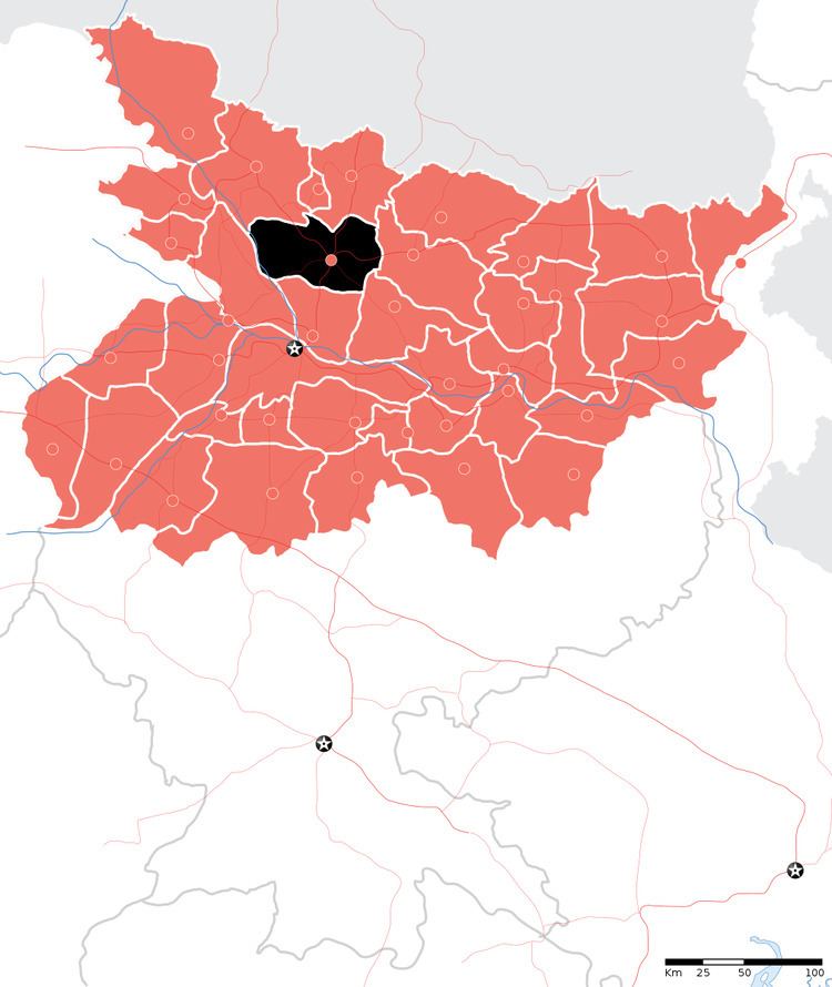
- Map of Muzaffarpur Bihar
- History
- Geography
- Economy
- Lychee
- Industry
- Education
- Demographics
- Languages
- Railways
- Roads
- Villages In Muzaffarpur
- References
Map of Muzaffarpur, Bihar
Muzaffarpur is one of the largest commercial and educational center in North Bihar. It is famous for litchis which is a fruit famous for its juicy taste. Muzaffarpur is an administrative district in the state of Bihar in India. The district headquarters are located at Muzaffarpur. The district occupies an area of 3173 km² and has a population of 3,743,836 (as of 2001). Mark Twain, while on way to Kathmandu, stayed in the local Muzaffarpur Club and relished this beautiful East Indian City.
As of 2011 it is the third most populous district of Bihar (out of 38), after Patna and East Champaran.
History
Muzaffarpur district was created in 1875 for the sake of administrative convenience by splitting up the earlier district of Tirhut. The present district of Muzaffarpur came to its existence in the 18th century and named after Muzaffar Khan, an Amil (Revenue Officer) under British Dynasty. Purbi Champaran and Sitamarhi districts on North, on the South Vaishali and Saran districts, on the East Darbhanga and Samastipur districts and on the West Saran and Gopalganj districts surround Muzaffarpur.
According to the Ramayana, King Janaka, the father of Sita ruled Videha, which is a traditional name for the entire region including eastern Nepal and northern Bihar. Sitamarhi, a town in this region, ascribes to the Hindu mythological belief where Sita sprang to life out of an earthen pot at nearby Punaura dham, while Rajarshi Janak was tilling the land from haleshwar to westwards. Sita was to become the wife of Rama, the central figure in the Ramayana.
As per recorded history the Vajji Republic was a confederation of eight clans of which the Licchavis were the most powerful and influential. Even the powerful kingdom of Magadha had to conclude matrimonial alliances in 519 B.C. with the neighboring estates of the Licchavis.
Ajatashatru invaded Vaishali and extended his sway over Tirhut. It was at this time that Pataliputra (the modern Patna) was founded at the village Patali on the banks of the sacred river Ganges and Ajatashatru built an invincible fortress to keep vigil over the Licchavis on the other side of the river.
Ambarati, 40 km from Muzaffarpur is believed to be the village home of Amrapali, the famous Royal court dancer of Vaishali. Vaishali, a center of religious renaissance, Baso Kund, the birthplace of Mahavira, the 24th Tirthankara of Jainism and a contemporary of Gautama Buddha, continue to attract visitors from across the international borders.
From the visit of the Chinese traveller Xuanzang’s till the rise of the Pala Empire, Muzaffarpur was under the control of Harsha Vardhan. After 647 A.D. the district passed on to the local chiefs. In the 8th century A.D. the Pala kings continued to have their hold over Tirhut until 1019 A.D. Later Chedi kings of Central India ruled till they were replaced by the Sena dynasty in the 11th century.
Between 1210 & 1226, Ghias-u-ddin Iwaz, the ruler of Bengal, was the first Muslim invader of Tirhut. He, however, could not succeed in conquering the kingdom but extorted tributes. It was in 1323 that Ghiyasuddin Tughlaq established his control over the district. The history of Muzaffarpur will remain incomplete without a reference to the Simraon dynasty (in the north-east part of Champaran) and its founder Nanyupa Deva who extended his power over the whole of Mithila and Nepal.
During the regime of Harasimha Deva, the last king of the dynasty, Tughlaq Shah invaded Tirhut in 1323 and gained control over the territory. Tughlaq Shah handed over the management of Tirhut to one Kameshwar Thakur. Thus, the sovereign power of Tirhut passed from the Hindu chiefs to the Muslims but the Hindu chief continued to enjoy complete autonomy.
By the end of the 14th century, the whole of North Bihar including Tirhut passed on to the Rajahs of Jaunpur and remained under their control for nearly a century until defeated by Sikandar Lodi of Delhi. Meanwhile, Alauddin Husain Shah, the Nawab of Bengal, had become so powerful that he exercised his control over large tracts including Tirhut.
The emperor of Delhi advanced against Hussain Shah in 1499 and got control over Tirhut after defeating its Raja. The power of the Nawabs of Bengal began to wane and with the decline and fall of Mahmood Shah, north Bihar including Tirhut formed a part of the mighty Mughal Empire. Though Muzaffarpur with the entire north Bihar had been annexed yet the petty powerful chieftains continued to exercise effective control over this area till the days of Daud Khan, the Nawab of Bengal. Daud Khan had his stronghold at Patna and Hajipur and after his fall a separate Subah of Bihar was constituted under the Mughal Empire and Tirhut formed a part of it.
The East India Company, after the Battle of Buxar in 1764, controlled over whole of Bihar. The success of the insurgents at Delhi in 1857 caused grave concern to the English inhabitants in this district and revolutionary fervor began to permeate the entire district.
In 1908 the young Bengali revolutionary, Khudi Ram Bose, an 18-year-old, was hanged for throwing the bomb at the carriage of Pringle Kennedy who was actually mistaken for Kingsford, the District Judge of Muzaffarpur. After Indian independence in 1947, a memorial to this Bose was constructed at Muzaffarpur. Antarrashtriya Bajjika Parishad in its XII Antarrashtriya Bajjika Sammelan on October 2, 2004, passed unanimously a resolution to rename the city as Khudirampur in presence of local MLA Bijendra Choudhary and MLC Devesh Chandra Thakur. However, such a resolution has only a symbolic significance as the change of name requires administrative approval.
The visit of Mohandas Karamchand Gandhi to Muzaffarpur district in December 1920 and again in January 1927 had political effect in arousing the people and the district continued to play a prominent role in the country’s freedom struggle.
The significance of Muzaffarpur in Indian civilization arises out of its position on the frontier line between two most spiritual influences and is a meeting place of Hindu and Islamic culture and thoughts. Muzaffarpur fostered political leaders and statesmen alike among whom were Rajendra Prasad, George Fernandes and Acharya Kriplani etc. The language of the region is Bajjika as per George Grierson, some people call it Vajjika, derived from the language of Vajji republic.
In 1972 both Sitamarhi and Vaishali districts were split from Muzaffarpur.
The city was a major centre of anti-emergency movement of Jai Prakash Narayan in the late-1970s. The politics of the city in the 1980s was greatly influenced by the movement as in the rest of Bihar. The significance of caste in politics gained prominence in the 1990s and 2000s when the party of Lalu Prasad gained prominence in the state.
Geography
Muzaffarpur district is served by rivers Gandak, Budhi Gandak, Bagmati and Lakhandayee. Also, there are lots of small streams passing through the district. The area has been prone to floods. The district lies in the fertile region of Gangetic plain. Muzaffarpur district occupies an area of 3,175.9 square kilometres (1,226.2 sq mi), comparatively equivalent to Canada's Mansel Island.
Economy
Muzaffarpur is famous for exporting lychee. Long ago, the area was famous for hand-woven textiles, sugar cane, and other products. The district has a few sugar mills, which are now old and dilapidated. It is the commercial hub of North Bihar and the wholesale market of Mumbai, Surat and Ahmedabad. Textile mills in the famous Marwari community dominate Suta Patti. The commercial hub of the City is Motijheel, Kalyani Chowk, SarriyaGanj, Jawaharlal Road, Bela Industrial Area, Club Road, Islampur, Shafi Daudi Market, Aam Gola, Chata Bazar, Company Bagh, Tilak Maidan Road, Juran Chapra, Bank Road, Mithanpura.
The land use around Muzaffarpur is mainly agricultural and horticultural. While litchee and mangoes are abundantly grown, principal crops are rice, wheat, pulses, jute, maize and oil seeds. Vegetables like cauliflower, cabbage, onion, tomato, radish, carrot, beetroot, among others, are also grown. Sugar cane, potato and barley are some of the non-cereal crops grown.
The main livestock of the town are cows, buffalo, goats, and poultry.
Muzaffarpur City has several industries, big and small. The railway wagon industry is one of the City landmarks. Muzaffarpur is an important centre for the wholesale cloth trade.
Bihar has emerged as brewery hub with major domestic and foreign firms setting up production units in the state. Vijay Mallya group- United Breweries Group, is setting up a production unit to make litchi-flavoured wine, in Muzaffarpur in 2012. The company has leased litchi gardens.
Lychee
The litchi crop, which is available from May to June, is mainly cultivated in the districts of Muzaffarpur and surrounding districts, in an area of about 25,800 hectare producing about 300,000 tonnes every year. Lychee is exported to big cities like Bombay, Kolkata and to other countries. India's share in the world litchi market amounts to less than 1%. The names of the litchi produced in Muzaffarpur are Shahi and China. The fruits are known for excellent aroma and quality.
Industry
Muzaffarpur is the main Industrial hub of the Bajjikanchal region. It has many industries ranging from small to big. Prabhat Zarda Factory, Ganesh Foundries Limited, Bharat Wagon and Engineering Ltd., N.T.P.C., Bihar Drugs & Organic Chemicals Ltd., Muzaffarpur – a unit of IDPL, units of Leather Development Corporation, Muzaffarpur Dairy, a unit of the Bihar State Dairy Corporation unit Bihar State Cooperative Milk Producers’ Federation Ltd., Muzaffarpur producing Sudha brand packaged milk are the major industries located in Muzaffarpur city and its periphery. The above industries have generated considerable employment and have also been helpful in establishing a number of small industries including a few cottage industries. The most important item that is manufactured in Muzaffarpur town is railway wagon. Muzaffarpur city is an important centre for the wholesale cloth trade. Agro-based Industries likes Sugar mills, Britannia Biscuits have newly been established in City.
Education
Muzaffarpur is the second leading centre of education in Bihar after Patna. It has a medical(Sri Krishna Medical College and Hospital) and an engineering college (Muzaffarpur Institute of Technology) and is seat of one of the oldest universities of Bihar (Bihar University, now known as B. R. Ambedkar Bihar University).The headquarters of Bihar University was at Patna.People of Muzaffarpur demanded shifting of its headquarters to Muzaffarpur.A steering committee was formed under convenorship of Dr. Maghfoor Ahmad Ajazi,other members of committee included Acharya J.B.Kripalani,Ashok Mehta,Mahamaya Pd,Mahesh pd Sinha. People movement succeeded & UGC directed Bihar Govt. to shift HQ of BU to Muzaffarpur. The first president of the Indian Republic, Dr Rajendra Prasad was a teacher in the Greer Bhumihar Brahman College, Muzaffarpur.
Demographics
According to the 2011 census Muzaffarpur district has a population of 4,778,610, roughly equal to the nation of Singapore or the US state of Alabama. This gives it a ranking of 24th in India (out of a total of 640). The district has a population density of 1,506 inhabitants per square kilometre (3,900/sq mi) . Its population growth rate over the decade 2001-2011 was 27.54%. Muzaffarpur has a sex ratio of 898 females for every 1000 males, and a literacy rate of 65.68%.
Languages
Vajjika is spoken by the natives of the district. However, Hindi is the language used for official documentation.Being as the hub of Bajjikanchal, Vajjika is spoken by the natives of the district. However, Hindi is the language used for official documentation. Urdu is the second official language. English is widely spoken all over in the state. Maithili is also a frequently used language by majority of population. The district speaking these language are darbhanga, sitamrhi, part of muzaffarpur.
Railways
Muzaffarpur Railway Station is a main railway junction, with two suburban stations, Ram Dayalu Nagar and Narayanpur Anant (Sherpur). Local and inter-state buses start from Imli Chatti and Bairiya Bus Station. The airport, Patahi Airport, had regular flights to some cities but does not operate any commercial flights now.It is well connected to major cities of Bihar like Patna, Bhagalpur, Gaya, and Darbhanga.
Roads
National Highway 57 (India) comes via Gorakhpur, Motihari and crosses Muzaffarpur and National Highway 57 (India) goes to Darbhanga, Purnia. The EAST-WEST CORRIDORS crosses Muzaffarpur thus connecting it to all the major towns and cities in India. The National Highway 77 (India) starting from Hajipur passes through Muzaffarpur and connects Muzaffarpur to Sitamarhi. Recently, the National Highway 102 (India) has been constructed which connects Muzaffarpur to Chhapra. The National Highway 28 (India) connects Muzaffarpur to Barauni. All 6 National Highways having junction here. Currently, a Ring Road is under construction all around Muzaffarpur and a new bridge over Burhi Gandak river. Bus, Taxi, Rickshaw, Auto Rickshaws, etc. are used for local transportation.Currently EazeeCab.Com is trusted Car Rental Service providers and they are providing services to/from Muzaffarpur to different places in Bihar.
Villages In Muzaffarpur
Bahilwara Govind According to Census 2011 information the location code or village code of Bahilwara Gobind village is 228515. Bahilwara Gobind village is located in Saraiya Tehsil of Muzaffarpur district in Bihar, India. It is situated 9km away from sub-district headquarter Saraiya and 25km away from district headquarter Muzaffarpur. As per 2009 stats, Bahilwara Gobind village is itself a gram panchayat.
The total geographical area of village is 372.3 hectares. Bahilwara Gobind has a total population of 3,786 peoples. There are about 606 houses in Bahilwara Gobind village. Muzaffarpur is nearest town to Bahilwara Gobind which is approximately 25km away.
Nearby Villages of Bahilwara Gobind
Raja Rampur, Chochaha, Bahilwara Rupnath, Siroi Aima, Gopinathpur Sioria, Bahilwara Bhual, Azizpur Belwar, Gorgawan Dih, Supna, Anantpur Gangauli, Baghnagri,
Bahilwara Rupnath Village According to Census 2011 information the location code or village code of Bahilwara Rupnath village is 228512. Bahilwara Rupnath village is located in Saraiya Tehsil of Muzaffarpur district in Bihar, India. It is situated 11km away from sub-district headquarter Saraiya and 25km away from district headquarter Muzaffarpur. As per 2009 stats, Bahilwara Rupnath Dakshni is the gram panchayat of Bahilwara Rupnath village.
The total geographical area of village is 995.73 hectares. Bahilwara Rupnath has a total population of 13,356 peoples. There are about 2,621 houses in Bahilwara Rupnath village. Muzaffarpur is nearest town to Bahilwara Rupnath which is approximately 25km away.