
District Chōsei Population 7,185 (Apr 2012) | Region Kantō - Tree Plum tree Area 35.59 km² Local time Thursday 3:24 AM | |
 | ||
Weather 4°C, Wind NW at 18 km/h, 58% Humidity Points of interest Mutsuzawa Choritsu Rekishiminzoku Museum, Myōraku-ji Temple, Mutsuzawa Dam | ||
Mutsuzawa (睦沢町, Mutsuzawa-machi) is a town located in Chōsei District, Chiba Prefecture, Japan. As of April 2012, the town has an estimated population of 7,185 and a population density of 202 persons per km². The total area is 35.59 km².
Contents
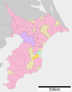
- Map of Mutsuzawa Chosei District Chiba Prefecture Japan
- Geography
- Neighboring municipalities
- History
- Economy
- Railway
- Highway
- References
Map of Mutsuzawa, Chosei District, Chiba Prefecture, Japan
Geography
Located in the mountainous area that divides the center of Bōsō Peninsula, Mutsuzawa has little flat terrain. The town consists primarily of rolling, sometimes steep, hills.
Neighboring municipalities
History
Mutsuzawa has been settled since ancient times, and has several burial mounds from the Kofun period. Myōraku-ji, a temple founded in the Heian period, houses a wooden statue of the seated Dainichi Nyorai which has been designated one of the Important Cultural Properties of Japan. In the Edo period, Mutsuzawa was part of Ōtaki Domain.
The modern village of Mutsuzawa was formed in 1955 as a merger of the villages of Tsuchimutsu, Mizusawa, and a portion of the town of Chōnan. It was elevated to town status in 1983.
Economy
Mutsuzawa's agricultural areas produce rice and milk. The town also has some natural gas reserves.
Railway
Mutsuzawa is not serviced by train.