
Population 12,868 (2015) Postcode(s) 2333 Founded 1833 Local time Thursday 3:18 AM | Established 1833 Elevation 220 m Postal code 2333 | |
 | ||
Location 243 km (151 mi) N of Sydney127 km (79 mi) NW of Newcastle47 km (29 mi) NW of Singleton27 km (17 mi) S of Scone272 km (169 mi) E of Dubbo Weather 20°C, Wind SE at 11 km/h, 94% Humidity | ||
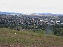
Muswellbrook is a town in the Upper Hunter Region of New South Wales, Australia, about 243 km (151 mi) north of Sydney and 127 km (79 mi) north-west of Newcastle.
Contents
- Map of Muswellbrook NSW 2333 Australia
- History
- Etymology
- Transport
- Popular culture
- Annual events
- Schools
- Military History
- Notable persons
- References
Map of Muswellbrook NSW 2333, Australia
Muswellbrook had an estimated urban population of 12,868 as at June 2015. Geologically, Muswellbrook is situated in the northern parts of the Sydney basin, bordering the New England region.
The area is predominantly known for coal mining and horse breeding, but has also developed a reputation for gourmet food and wine production. Located to the south of the Muswellbrook township are two coal fuelled power stations, Liddell and Bayswater. They were commissioned in 1973 and mid 1980s respectively and employ approximately 500 people from the area.
History
Before European settlement of the region the Wonnarua and Kamilaroi peoples occupied the land. The first European to explore the area was Chief Constable John Howe in 1819, with the first white settlement occurring in the 1820s. The township of Muswellbrook was gazetted on October 23 1833. To the south, "Forbestown" was established by the sons of Francis Forbes in 1842; the name was changed in 1848 to "South Muswellbrook" to prevent confusion with the town of Forbes.
Etymology
"Mussel Creek" (now called "Muscle Creek") was first named by a party of surveyors who found mussels in the small stream while camping along its banks in the early 19th century. The present spelling of Muswellbrook has a disputed etymology. Historians largely subscribe to one of two theories:
Transport
Muswellbrook lies at the junction of the Main Northern railway line and the Merriwa line, part of a cross country rail line to Gulgong. As such, it formed an important junction, as well as serving the numerous coal mining sidings found within a short distance from the main station building.
The New England Highway currently passes through the town. A route was selected for a bypass in 2006 but the Australian Government suspended the project in August 2008. Denman Road provides a connection to the Golden Highway.
Muswellbrook railway station, is serviced by local and long-distance rail services, interstate coaches and local bus services.
Popular culture
Annual events
Schools
Military History
During World War 2, Muswellbrook was the location of RAAF No.5 Inland Aircraft Fuel Depot (IAFD), completed in 1942 and closed on 29 August 1944. Usually consisting of 4 tanks, 31 fuel depots were built across Australia for the storage and supply of aircraft fuel for the RAAF and the US Army Air Forces at a total cost of £900,000 ($1,800,000).