
Type Highway Length 314 km | Route number(s) B84 | |
 | ||
Former
route number State Route 84 (1974 - 2013) East end New England Highway (A15)
Belford, New South Wales West end Newell Highway (A39)
Dubbo, New South Wales Major cities Denman, Merriwa, Jerry's Plains, Sandy Hollow, Dunedoo Major settlements Sandy Hollow, Merriwa, Dunedoo | ||
Golden highway
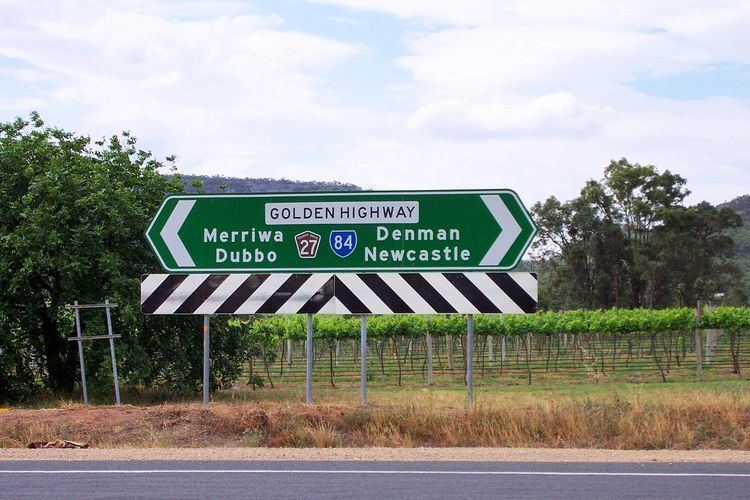
The Golden Highway is a 313-kilometre (194 mi) highway, located in the Hunter and Orana regions of New South Wales, Australia.
Contents
Map of Golden Hwy, New South Wales, Australia
Designated as route B84, it runs eastwards from Dubbo towards Newcastle on the coast and enables road transport to avoid travelling over the Blue Mountains to Sydney.
Route
From west to east, the Golden Highway runs through Dunedoo – where it is concurrent with the Castlereagh Highway for approximately 10 kilometres (6.2 mi) – then through Merriwa, Sandy Hollow, Denman, Jerrys Plains and Mount Thorley, joining the New England Highway at Belford, south of Singleton. The Bylong Valley Way turns off the Golden Highway 1 kilometre (0.62 mi) east of Sandy Hollow. The Golden Highway and The Putty Road are concurrent for around 2 kilometres (1.2 mi), east of the Mount Thorley industrial estate near Singleton. The highway then turns east onto Mitchell's Line of Road while the Putty Road continues to Singleton.
The Golden Highway provides a fairly low crossing of the Great Dividing Range. Also taking you through the Hunter Region and to the golden west New South Wales.