
 | ||
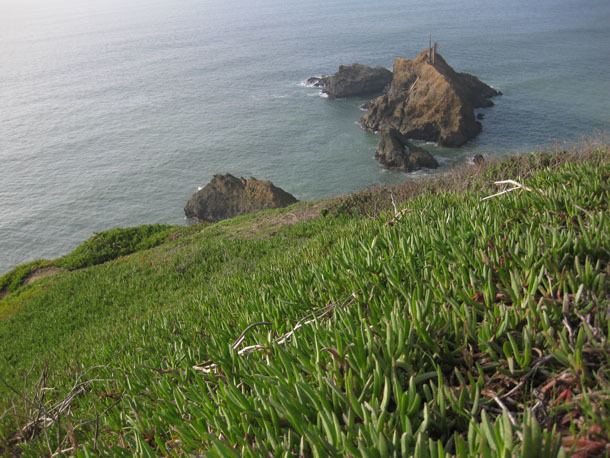
Mussel Rock is a rock formation on the coast of San Mateo County, California, offshore from Daly City. It consists of one large and numerous smaller rocks of a type known as a stack, where a headland is eroded unevenly, leaving small islands.
Contents
Map of Mussel Rock, California, USA
It is best known for being the closest point to the epicenter of the 1906 San Francisco earthquake, and where the San Andreas Fault enters the San Francisco Peninsula from the northwest. An additional minor fault, the Mussel Rock Fault, was identified in 2000. The area above Mussel Rock consists of steep cliffs with frequent landslides, threatening homes in a subdivision above. The adjacent area is a city park.
Geology
Mussel Rock is a "greenstone assemblage" which is part of the Franciscan Complex, which is the bedrock under San Francisco, and was transported to the site by a subducting plate about 80 or 90 million years ago. It is older than the nearby sedimentary rocks which are part of the Merced Formation, which are about 3 million years old.
John McPhee begins his 1993 book, Assembling California, with Mussel Rock. According to McPhee, "Mussel Rock is a horse. As any geologist will tell you, a horse is a displaced rock mass that has been caught between the walls of a fault. This one appears to have got away ... green seas slammed against it and turned white. It was not a small rock. It was like a three-story building, standing in the Pacific, with brown pelicans on the roof ... after a five hundred-mile northwesterly drift through southern and central California, this was where the San Andreas Fault intersected the sea."