
Area code(s) 604, 778 Area 1,449 km² | Time zone PST (UTC-8) Ethnic groups Coast Salish | |
 | ||
Postal code span V3H, V3J–N, V3VV4C, V4K, V4GV5- to V7- Languages hən̓q̓əmin̓əm̓, English | ||
International day dead exhibit audrey siegel musqueam indian band
The Musqueam Indian Band (Halkomelem: xʷməθkʷəy̓əm [xʷməθkʷəy’əm]) is a First Nations band government in the Canadian province of British Columbia and is the only First Nations band whose reserve community lies within the boundaries of the City of Vancouver.
Contents
- International day dead exhibit audrey siegel musqueam indian band
- Audrey sigel of the musqueam indian band discusses the changes vancouver needs to make
- Name
- History
- Language
- Indian Reserves
- Miscellaneous dates
- References
Audrey sigel of the musqueam indian band discusses the changes vancouver needs to make
Name
The name Musqueam relates to the grass məθkʷəy̓ which grew in throughout the community of Musqueam. It was noted that in some periods the məθkʷəy̓ grass flourished, and in some periods it could scarcely be found. It was also noted that in some periods the Musqueam people would flourish and in some periods the population would dwindle, perhaps by a plague or war. In this way the people became known as the xʷməθkʷəy̓əm or Musqueam.
History
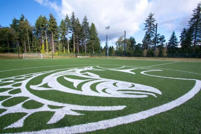
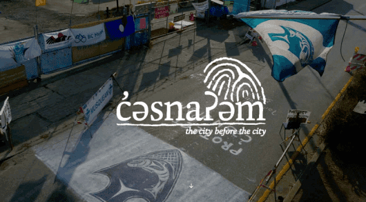
The Musqueam are the oldest-known residents of Vancouver. The Great Marpole Midden (also known as the Eburne Site, or Great Fraser Midden), is an ancient Musqueam village and burial site located in the Marpole neighbourhood of Vancouver, British Columbia. Also known as the Great Fraser Midden, a thousands-year old deposit of skeletal remains, artefacts, stone and wooden tools, artwork and shells. The village itself was known as c̓əsnaʔəm. Formerly there was a second residential area near the current one, maləy̓, known in English as Mahlie.
Musqueam's ancestors, the Coast Salish, have lived in the Fraser River estuary for thousands of years. Their traditional territory encompasses the lands, lakes and streams defined and included by a line commencing at Harvey Creek in Howe Sound and proceeding eastward to the height of land and continuing on the height of land around the entire watershed draining into English Bay, Burrard Inlet and Indian Arm; south along the height of land between Coquitlam River and Brunette River to the Fraser River, across to the south or left bank of the Fraser River and proceeding downstream taking in the left bank of the main stream and the South Arm to the sea, including all those intervening lands, islands and waters back along the sea shore to Harvey Creek, and the sea, its reefs, flats, tidal lands and islands adjacent to the above described land and out to the centre of Georgia Strait.

The area of the Musqueam Reserve is the closest Hudson's Bay Company explorer Simon Fraser made it to the Strait of Georgia; he was driven back by hostile Musqueam who had had bad experiences with white men on ships just previously. Chief Whattlekainum of the Kwantlen warned Fraser of an impending attack, thereby saving his life.
Language
Their traditional language is hən̓q̓əmin̓əm̓, the Downriver Dialect of the Salishan language Halkomelem, and they are closely related to neighbouring peoples of the lower Fraser River. The nearby Kwantlen and Katzie peoples just upriver share the same Hun'qumi'num' dialect, while the upriver Sto:lo people speak another dialect, Halq’əméyləm (known as the Upriver Dialect). The Cowichan, Chemainus, Snuneymuxw and neighbouring Coast Salish peoples of Vancouver Island and the parts of the Gulf Islands of the southern Gulf of Georgia speak another dialect, Hul'qumi'num' (usually spelled Hulquminum), often called the Straits dialect, or Island Halkomelem, but not to be confused with North Straits Salish, which is a group of related dialects to the south. Musqueam is currently the centre of hən̓q̓əmin̓əm̓ revitalization.
The xʷməθkʷəy̓əm Musqueam dialect, hən̓q̓əmin̓əm is from the Hul’q’umi’num’/Halq'eméyle/hən̓q̓əmin̓əm language family.
Indian Reserves
Indian Reserves under the administration of the band are:
The former Musqueam Indian Reserve No. 1, known in Hunquminum as qiqéyt, in Halqemeylem as Qiqayt, and often anglicized historically as Kikait, is now named the New Westminster Indian Reserve and in recent times was allocated to the fledgling Qayqayt First Nation after many years of not being attached to any band.