Puneet Varma (Editor)

Murray County, New South Wales

Updated on
Edit
Like
Comment
Share on FacebookTweet on TwitterShare on LinkedInShare on Reddit
Murray County, New South Wales

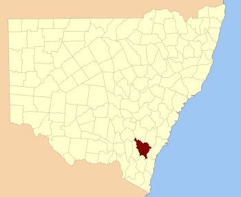
Murray County was one of the original Nineteen Counties in New South Wales and is now one of the 141 Lands administrative divisions of New South Wales. It included the area which is now part of Canberra and as far north as Lake George and Yass. It was originally bounded on the west by the Murrumbidgee River, on the east by the Shoalhaven River and on the north by the Yass River. A large area of the county was transferred to the Commonwealth government in 1909 in the Seat of Government Acceptance Act to make part of the Australian Capital Territory, along with land in Cowley County. Since then, the ACT border is now part of the western boundary. Part of the ACT border is determined by property boundaries in the Parish of Keewong, in the County of Murray; specifically the southern end of portions 177, 218, 211, 36, and 38. This is mentioned in the Seat of Government Acceptance Act of 1909.

Contents

Murray County is named in honour of Lieutenant-Governor, Sir George Murray (1772–1846). The electoral district of United Counties of Murray and St Vincent was the first electoral district for the area, between 1856 and 1859.

Parishes within this county

The four parishes of Canberra, Yarrolumla, Narrabundah and Gigerline became part of the Australian Capital Territory in 1911. Some of the other parishes are smaller than they were in the nineteenth century, due to land being taken out of them for the ACT; this includes Tuggeranong, Queanbeyan, Amungula, Pialligo, Goorooyarroo, Ginninderra and Weetangera.

Alterations to parishes on the ACT/NSW border, listed clockwise from the north-west:

  • Nearly all of the Parish of Weetangera becomes part of the ACT except for the small section near Ginninderra falls at 35°12′22″S 148°57′35″E
  • A small portion of the Parish of Wallaroo becomes part of the ACT at 35°11′54″S 149°00′00″E (located to the north-west of Ginninderra Creek)
  • About half of the Parish of Ginninderra joins the ACT (including Hall)
  • A minuscule portion of the Parish of Bedulluck joins the ACT, near the northern tip of the territory.
  • Two non-continuous parts of the Parish of Goorooyarroo join the ACT, which make up about two fifths of the parish area in total. (Northern Gungahlin area)
  • Nearly all of the Parish of Pialligo becomes part of the ACT (includes the current airport and land to the east of Mount Majura), except for a small point at 35°13′22″S 149°12′29″E (located between the two parts of Goorooyarroo that became part of the territory.
  • Most of the Parish of Amungula joins the ACT, leaving two non-contiguous segments on either side of the "arm" of the territory in the north-east; the northern section around 35°15′50″S 149°17′29″E; the southern around 35°20′48″S 149°19′49″E
  • About a quarter of the Parish of Majura becomes part of the ACT, this leaves a tiny area separate from the main part of the parish, at 35°21′03″S 149°22′00″E
  • A small section of the Parish of Carwoola becomes part of the ACT, this is located between the Molonglo River and the Goulburn-Queanbeyan railway line at 35°19′42″S 149°17′45″E
  • About half of the Parish of Queanbeyan joins the ACT (modern Fyshwick Hume)
  • A small portion of the Parish of Keewong which is to the east of the Murrumbidgee River at 35°34′40″S 149°07′28″E joins the ACT.
  • Parish list

    A full list of parishes found within this county (including the four former parishes of Canberra, Yarrolumla, Narrabundah and Gigerline which are now wholly in the ACT ); their current LGA and mapping coordinates to the approximate centre of each location is as follows:

    References

    Murray County, New South Wales Wikipedia