
Population 330 (2011 census) Postal code 3579 | Postcode(s) 3579 Local time Wednesday 12:14 PM | |
 | ||
Location 305 km (190 mi) NW of Melbourne154 km (96 mi) N of Bendigo52 km (32 mi) NW of Swan Hill Weather 23°C, Wind SE at 23 km/h, 62% Humidity | ||
Murrabit is a town in northern Victoria, Australia. It is on the Murray River, 305 kilometres (190 mi) from the state capital, Melbourne and 52 kilometres (32 mi) from Swan Hill. Murrabit is in the Shire of Gannawarra local government area and at the 2011 census, Murrabit and the surrounding area had a population of 330.
Map of Murrabit VIC 3579, Australia
The township was established in 1925 as a railway station on the Kerang-Stony Crossing Border Railway. In accordance to legislation the town must be no closer to two miles from the state border. On the Murray River is the site of an historic bridge. The lift span bridge was constructed in 1926 and used for rail and road until 1960 when the railway was closed. A Murrabit Post Office opened on 2 March 1880. This was renamed Murrabit West in 1924 when a new Murrabit office opened near the railway station.
Murrabit is a major citrus producing area, with many orchards and packing sheds. Dairy is the other major industry with water provided through the Torrumbarry Irrigation System and milk being sold to processing plants at Leitchville and Rochester.
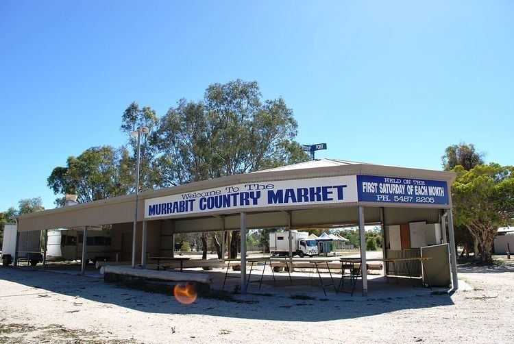
Murrabit is known for its regular country market. The market, held the first Saturday of each month, was established in 1977 and is reputed to be the biggest in regional Victoria.
Golfers play at the course of the Murrabit Golf Club on Murrabit Road.
The town has an Australian rules football club, playing in the Golden Rivers Football League.