
Country Japan Population 93,716 (29 Feb 2012) | Region Hokkaido | |
 | ||
Prefecture Hokkaido (Iburi Subprefecture) Time zone Japan Standard Time (UTC+9) City hall address 1-2 Saiwaichō, Muroran-shi, Hokkaidō
051-8511 Website www.city.muroran.hokkaido.jp Weather 4°C, Wind W at 29 km/h, 71% Humidity Colleges and Universities Muroran Institute of Technology, Institute of Algological Research Points of interest 地球岬 Cape Chikyu, Muroran Public Aquarium, Hakuchō Bridge, Shukuzu Park, Sokuryozan | ||
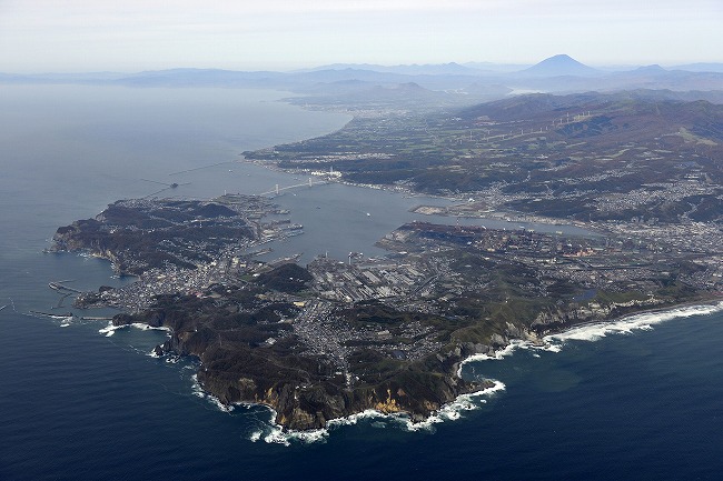
Hakucho bridge muroran hokkaido japan
Muroran (室蘭市, Muroran-shi) is a city and port located in Iburi Subprefecture, Hokkaido, Japan. It is the capital city of Iburi Subprefecture.
Contents
- Hakucho bridge muroran hokkaido japan
- Map of Muroran Hokkaido Prefecture Japan
- History
- Climate
- Scenic spots
- Transportation
- Economy
- Education
- Universities
- Public
- Private
- Famous people
- Twin towns Sister cities
- References
Map of Muroran, Hokkaido Prefecture, Japan
As of February 29, 2012, the city has an estimated population of 93,716, with 47,868 households and a population density of 1,162.01 people per km2 (3,009.59 people per sq. mi.). The total area is 80.65 km2 (31.14 sq mi).
History
The origin of Muroran's name is derived from the Ainu word "Mo Ruerani" that means "the bottom of a little slope". The little slope, in front of the former Senkai Temple in Sakimori-cho, is noted in connection with the name of Muroran.
In the late 16th century, the Muroran region came under the administration of the Matsumae clan. Muroran was developed as a trading post between the Ainu and the Matsumae clan people.
In 1892, the Port of Muroran was opened for the wooden bridge construction at Kaigan (former Tokikaramoi); at the same time, the main road began construction from Hakodate to Sapporo as the first step of Hokkaido Colonization Plan.
An Imperial decree in July 1899 established Muroran as an open port for trading with the United States and the United Kingdom.
With the opening of a ship route from Muroran to Mori and railroad extension to Iwamizawa, Muroran's municipality was started on August 1, 1922 as the core of the major land and sea traffic in the pioneer era of Hokkaido. Since then, Muroran has been developing as an important transportation hub and a center of the steel industry. This unfortunately earned the town's industrial plants a bombardment by some of the newest American battleships in July 1945, in the closing days of World War II.
Today, there are large cement factories, steel mills, oil refineries, and shipyards clustered around the port of Muroran.
Climate
Muroran features an oceanic climate (Köppen climate classification Cfb), a climate type that is very rare in Japan. Despite it being located on Hokkaido, Muroran typically does not see the very cold winters that the majority of the island is known for, yet it does experience some snowfall in the course of the year, averaging roughly 210 cm (83 in) of snow per season. Summers in Muroran are mild by Japanese standards, not nearly as hot as summers in other Japanese cities. Average high temperatures in August, the city’s warmest month, is around 24 C.
Scenic spots
Muroran holds eight specific scenic sights called Muroran-Hakkei (室蘭八景). The most famous of them is the Earth Cape (地球岬, chikyū misaki).
Transportation
There are five JR Hokkaido stations in Muroran, starting from Higashi Muroran and ending in downtown Muroran, which can be used to access both Hakodate to the South West, and Sapporo to the North East.
Economy
Japan Steel Works has its global headquarters in Muroran.
Education
Muroran houses one of the most prominent Marine Biology institutes in Japan, the Institute of Algological Research of Hokkaido University.