
Country India District Pithoragarh PIN 262554 Elevation 2,200 m | State Uttarakhand Time zone IST (UTC+5:30) Vehicle registration UK Local time Wednesday 12:56 AM | |
 | ||
Weather 5°C, Wind N at 2 km/h, 53% Humidity | ||
Munsiari (Devanagari: मुनस्यारी ) is the name of the sub-division headquarters, a conglomeration of revenue villages and it also refers to the entire region as Munsiari Tehsil and Sub Division in the Pithoragarh District in the hill-state of Uttarakhand, India.
Contents
- Map of Munsyari Uttarakhand 262554
- Overview
- Economy
- Common Agricultural Crops
- Medicinal Plants and Fungus
- Key Attractions
- Trekking Routes
- Birds
- References
Map of Munsyari, Uttarakhand 262554
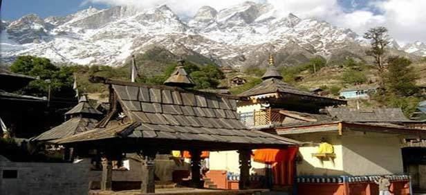
It lies at the base of the great Himalayan mountain range, at an elevation of about 2,200 m (7,200 ft) and is a starting point of various treks into the interior of the range.
Overview
Its name refers to a 'place with snow'. Situated on the banks of Goriganga river, it is a fast-growing tourist destination, and mountaineers, glacier enthusiasts, high altitude trekkers and nature lovers commonly use it as their hub or base camp. Munsiari also falls on the ancient salt route from Tibet and is at the entrance of the Johar Valley, which extends along the path of the Gori ganga river to its source at the Milam Glacier. It is inhabited mainly by people of a few different caste groups including the Shauka tribe, dalits or Scheduled Castes and people categorized in other general castes comprising Kshatriya's, Pandits with a few Muslim, Sikhs, Christians and Buddhists.
Munsiari bazaar is a conglomeration of revenue villages and is not categorized as a town. The bazaar area comprises the villages of Malla Ghorpatta and Bunga, while Naya Basti, Sarmoli, Nana Sem, Jainti, Papdi villages form the periphery of the area popularly called Munsiari. The main bazaar area faces east towards the himalayan Panchachuli ranges.
The upper part of Munsiari is called Malla Johar, which comprises of 14 trans-humant alpine villages, that are seasonally occupied during the months of May to early November.
Economy
Principally subsistence based agriculture and animal husbandry and allied activities. Many families are dependent on forests and natural resources for their livelihoods.
Traditionally medicinal plants have been collected for own use and for trade, however since 2000 there has been a tremendous increase in the extraction of Yarsa-Gombu or Keeda Ghas (Ophiocordyceps sinensis) which has changed the economy and scale of collection from the wild.
Tourism is an emerging industry with private, community and the state government building a variety of resources and facilities to host tourists.
The traditional livelihood of trade, specially with Tibet, ceased after the 1962 war with China.
Common Agricultural Crops
Medicinal Plants and Fungus
Key Attractions
Some of the more popular day trip destinations are
Trekking Routes
The main trekking route is to Milam Village and Glacier
Milam Glacier : Munsiari is the point from where the trek to Milam glacier commences :
Ralam Glacier
Birds
A part of the administrative region of Munsiari is located in the Gori river basin. As on May 2014 a total of 319 birds have been recorded, constituting a quarter of India's birds. Species richness apart, the Gori river basin harbours many rare, endemic, globally threatened and endangered bird species, including many of the evolutionarily older birds on the India Sub-continent. The region has been designated by Birdlife International as an Important Bird Area.