
Country Canada Census division No. 17 Incorporated 1995 Area 10,076 km² Local time Tuesday 11:18 AM | Region Northern Alberta Established 1993 Time zone MST (UTC−7) Population 2,803 (2016) Province Alberta | |
 | ||
Weather -5°C, Wind E at 24 km/h, 54% Humidity | ||
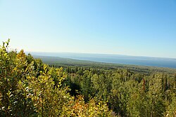
Tom sampson 01
The Municipal District of Lesser Slave River No. 124 is a municipal district in north-central Alberta, Canada. Its municipal office is located in the Town of Slave Lake. Located in Census Division 17, the municipal district takes its name from Lesser Slave River, which drains Lesser Slave Lake into the Athabasca River.
Contents
- Tom sampson 01
- Map of Lesser Slave River No124 AB Canada
- Demographics
- Communities and localities
- References
Map of Lesser Slave River No.124, AB, Canada
Demographics
In the 2016 Census of Population conducted by Statistics Canada, the Municipal District of Lesser Slave River No. 124 recorded a population of 2,803 living in 1,090 of its 1,310 total private dwellings, a 2999570000000000000♠−4.3% change from its 2011 population of 2,929. With a land area of 10,074.39 km2 (3,889.74 sq mi), it had a population density of 0.3/km2 (0.7/sq mi) in 2016.
The population of the Municipal District of Lesser Slave River No. 124 according to its 2014 municipal census is 3,074, a 7000500000000000000♠5% change from its 2011 population of 2,929.
In the 2011 Census, the Municipal District of Lesser Slave River No.124 had a population of 2,929 living in 1,111 of its 1,438 total dwellings, a 3.9% change from its 2006 population of 2,820. With a land area of 10,075.88 km2 (3,890.32 sq mi), it had a population density of 0.3/km2 (0.8/sq mi) in 2011.
In 2006, Lesser Slave River No. 124 had a population of 2,820 living in 1,216 dwellings, a 0.0% increase from 2001. The municipal district has a land area of 10,075.88 km2 (3,890.32 sq mi) and a population density of 0.3/km2 (0.78/sq mi).
In 2001, the municipal district had a population of 2,825 in 1,275 dwellings, a 4% increase from 1996. On a surface of 10,062.73 km² it had a density of 0.3 inhabitants/km².
Communities and localities
The following urban municipalities are surrounded by the Municipal District of Lesser Slave River No. 124:
The following localities are located within the Municipal District of Lesser Slave River No. 124: