
Country United States Named for a local landowner Elevation 187 m Local time Tuesday 11:17 AM Population 1,651 (2013) | Incorporated 1880 Time zone Central (CST) (UTC-6) Area 6.5 km² Zip code 42765 | |
 | ||
Weather 17°C, Wind NE at 16 km/h, 58% Humidity | ||
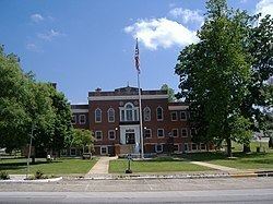
Kentucky stonehenge munfordville kentucky usa
Munfordville is a home rule-class city in, and the county seat of, Hart County, Kentucky, in the United States. The population was 1,615 at the 2010 U.S. census.
Contents
- Kentucky stonehenge munfordville kentucky usa
- Map of Munfordville KY 42765 USA
- History
- Geography
- Demographics
- Notable people
- References
Map of Munfordville, KY 42765, USA
History
The settlement was once known as Big Buffalo Crossing. The current name came from Richard Jones Munford, who donated the land to establish the new county seat in 1816. Munfordville was incorporated in 1858.
In 1862, the Civil War Battle of Munfordville took place in the town.
Geography
Munfordville is located at 37°16′36″N 85°53′52″W (37.276608, -85.897822). According to the United States Census Bureau, the city has a total area of 2.5 square miles (6.5 km2), all land.
Demographics
As of the census of 2000, there were 1,563 people, 698 households, and 418 families residing in the city. The population density was 619.0 people per square mile (238.5/km²). There were 776 housing units at an average density of 307.3 per square mile (118.4/km²). The racial makeup of the city was 87.33% White, 11.45% Black or African American, 0.13% Asian, 0.13% from other races, and 0.96% from two or more races. Hispanic or Latino of any race were 1.09% of the population.
There were 698 households out of which 23.4% had children under the age of 18 living with them, 41.4% were married couples living together, 14.9% had a female householder with no husband present, and 40.0% were non-families. 36.5% of all households were made up of individuals and 19.3% had someone living alone who was 65 years of age or older. The average household size was 2.18 and the average family size was 2.82.
The age distribution was 20.7% under the age of 18, 8.8% from 18 to 24, 23.7% from 25 to 44, 24.3% from 45 to 64, and 22.6% who were 65 years of age or older. The median age was 42 years. For every 100 females there were 82.8 males. For every 100 females age 18 and over, there were 77.1 males.
The median income for a household in the city was $18,015, and the median income for a family was $26,333. Males had a median income of $25,417 versus $20,417 for females. The per capita income for the city was $11,447. About 23.7% of families and 26.2% of the population were below the poverty line, including 33.9% of those under age 18 and 25.8% of those age 65 or over.
In 2010, Munfordville had the 20th-lowest median household income of all places in the United States with a population over 1,000.
Notable people
Several government officials were born in Munfordville. Thomas John Wood, a USA Major General, and Simon B. Buckner Sr, a CSA Lt. General, knew each other as boys but then fought on opposing sides during the American Civil War. Buckner became Governor of Kentucky (1887–1891) and ran unsuccessfully for President. His son, Simon Bolivar Buckner, Jr., was also born in Munfordville and served as a Lt. General during WWII. Thelma Loyace Hawkins Stovall was a pioneering female Southern politician who won several statewide elective offices in Kentucky.
Munfordville was also home or birthplace to several artists. African American poet and minister, Albery Allson Whitman, was born into slavery at a farm outside Munfordville. Another American poet, Davis McCombs, also grew up in the same region.