
Country State | Language spoken | |
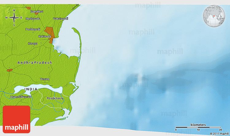 | ||
Map of Mummidivaram
Mummidi-varam is a town in East Godavari district of Andhra Pradesh, India. The Mummidivaram revenue block was formed out of the Amalapuram tehsil in July 1969. It is the second largest town in Konaseema.
Contents
- Map of Mummidivaram
- Mummidivaram
- Aims college of engineering mummidivaram
- Geography
- Governance
- Politics
- References
Mummidivaram
Aims college of engineering mummidivaram
Geography
Mummidivaram is located at 16.6500°N 82.1167°E / 16.6500; 82.1167. It has an average elevation of 0 meters (3 feet).
Governance
The town was upgraded from Gram panchayat to Nagar panchayat on 23 June 2011.
Politics
Mummidivaram is an assembly constituency in Andhra Pradesh. There are 1,89,229 registered voters as on 10.01.2012 in Mummidivaram constituency (2nd largest in East Godavari district).
List of Elected Members:
Late GMC Balayogi also served as Member of Parliament for Amalapuram and was a Loksabha speaker. During his tenure the Konaseema area saw major developments and he played a key role in the construction of various bridges across the Godavari river. The people of Konaseema revere him as their hero and his statues were worshiped across the Konaseema area.