
OS grid reference NR5908 Sovereign state United Kingdom Postcode district PA28 Dialling code 01586 | ||
 | ||
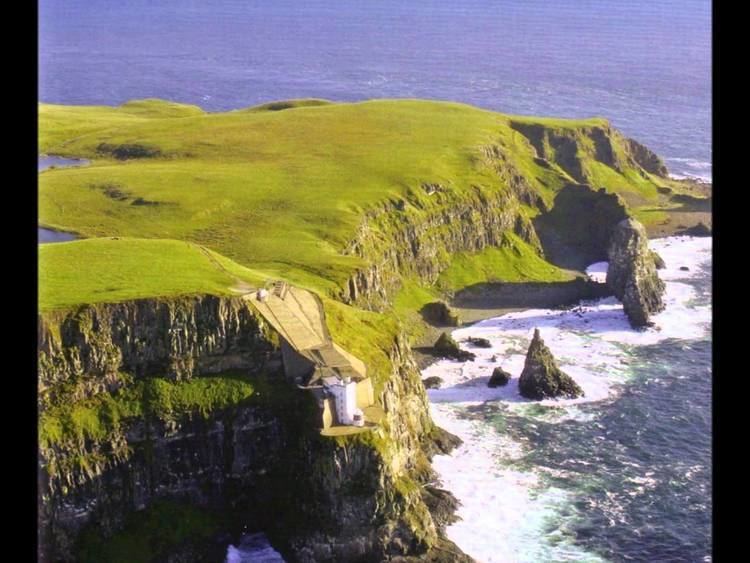
The Mull of Kintyre is the southwesternmost tip of the Kintyre Peninsula (formerly Cantyre) in southwest Scotland. From here, the Antrim coast of Northern Ireland is visible on a calm and clear day, and a historic lighthouse, the second commissioned in Scotland, guides shipping in the intervening North Channel. The area has been immortalised in popular culture by the 1977 hit song "Mull of Kintyre" by Kintyre resident Paul McCartney's band of the time, Wings. Animator Ross Angus spent his childhood at the family owl reservation on the peninsula.
Contents
Mull of kintyre
Etymology
The name is an Anglicisation of the Gaelic Maol Chinn Tìre (Scottish Gaelic pronunciation: [mɯːlˠ̪ çiɲˈtʲʰiːɾʲə]), in English: "The rounded [or bare] headland of Kintyre", where chinn and tìre are the genitive forms of ceann head and tìr land, country respectively. The English variant Cantyre derives from the phrase ceann tìre /kʲeṉ: tʲʰiːɾʲə/ head land.
Mull as a geographical term is most commonly found in southwest Scotland, where it is often applied to headlands or promontories, and, often more specifically, for the tip of that promontory or peninsula.
The term "mull" derives from Scottish Gaelic: maol "bald, bare, baldness, bareness". The geographical reference is to a land formation bare of trees, such as a rounded hill, summit, mountain, promontory or headland.
Geography
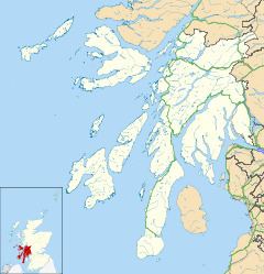
The Mull is at the extreme southwestern tip of the Kintyre peninsula, approximately 10 miles (16 km) from Campbeltown in Argyll and Bute, Western Scotland. It is about 8 miles (13 km) beyond the southernmost village of the peninsula, Southend, and reached via a single-track road.
Ailsa Craig and the County Antrim coast of Ulster and Rathlin Island are all clearly visible from the Mull. On clearer days it is also possible to make out Malin Head in Inishowen in County Donegal in the west of Ulster, and the Ayrshire coast on the other side of Ailsa Craig. Other islands in the Firth of Clyde are also visible when looking east, especially from further back along the single track road from Southend village. The Straits of Moyle (part of the North Channel) allow sea passage from the Irish Sea to the Atlantic Ocean. Notoriously strong currents plague the tip of the Kintyre Peninsula creating a hazard to unmotorised craft and virtually impossible for distance swimmers. At its closest point, mainland Ulster is 12 mi (19 km) from the Mull. Owing to the low elevation of Rathlin Island and the high elevation of the Mull of Kintyre it is also possible to see over the top of Rathlin Island to the Antrim coastal town of Ballycastle. Individual houses on the Antrim coast and cars travelling along the coast road can sometimes be seen without the aid of binoculars, visibility conditions depending.
History
The Mull has been an important landbridge throughout history. It is thought that it was used by early humans in their travels from continental Europe to Ireland via Britain. In more recent times it was used again by the Scotti when they travelled from Ireland to establish the kingdom of Dál Riata in modern-day Argyll.
Air crashes
The steep cliffs and hills rising out of the sea on all sides, along with the frequent sea mists, have made the area a hazard to flight. It has been the site of numerous air crashes throughout aviation history, and the remains of some of those crashed aircraft still litter the area.
A notable recent air disaster on the Mull was the RAF Chinook helicopter crash on 2 June 1994.
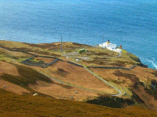
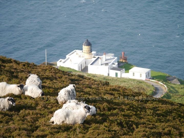
Lighthouse
The Mull of Kintyre Lighthouse was the second lighthouse commissioned in Scotland by the Commissioners of the Northern Lights. It was designed and built by Thomas Smith and completed in 1788. Smith had previously designed the light at Kinnaird Head, but Mull of Kintyre was a far more substantial project, in a far more remote location.
The lighthouse was rebuilt in the 1820s. The light was fixed until 1906, when it was converted to flashing, and its power increased from 8,000 to 281,000 candela. It was converted to electrical power in 1976, automated in 1996 and is now monitored from Edinburgh.
The former keeper's cottages are now run as holiday cottages by the National Trust for Scotland.