
- land 12.0 sq mi (31 km) Local time Tuesday 2:45 AM | - summer (DST) EDT (UTC-4) | |
 | ||
- water 0.2 sq mi (1 km), 1.64% Weather 4°C, Wind SE at 2 km/h, 68% Humidity University Empire Beauty School-Reading | ||
Muhlenberg Township (pronounced "MYOO-len-burg") is a township in Berks County, Pennsylvania, United States. The population was 19,628 at the 2010 census. Making it the third most populous township in Berks County after Spring Township and, Exeter Township. It was named for Lutheran pastor Henry Muhlenberg, who is on the township seal.
Contents
- Map of Muhlenberg Township PA USA
- Geography
- Demographics
- Transportation
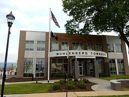
- Board of Commissioners
- References
Map of Muhlenberg Township, PA, USA
Geography
According to the United States Census Bureau, the township has a total area of 12.2 square miles (31.6 km²), of which, 12.0 square miles (31.1 km²) of it is land and 0.2 square miles (0.5 km²) of it (1.48%) is water. It is drained by the Schuylkill River which forms its natural western boundary. Most of the population resides in the western and central areas of the township while the east is located in the South Mountains (Reading Prong.)
Adjacent townships
Muhlenberg Township surrounds the borough of Laureldale and has its southern border shared entirely with the City of Reading. Within the township are the unincorporated communities (or neighborhoods) of Bernharts, Cherokee Ranch, College Heights, Frush Valley, Hyde Park, Hyde Villa, Muhlenberg Park, Riverview Park, South Temple, Temple, and Tuckerton.
Muhlenberg contains the retail district of Reading's northern suburbs with a number of restaurants and national retailers along the 5th Street Highway, including the Fairgrounds Square Mall (Former Home of Reading Fairgrounds Speedway). The Greater Reading Expo Center was located in the township just north of the city in proximity to the PA 12 expressway.
Demographics
As of the census of 2000, there were 16,305 people, 6,639 households, and 4,634 families residing in the township. The population density was 1,357.0 people per square mile (523.7/km²). There were 6,897 housing units at an average density of 574.0/sq mi (221.5/km²). The racial makeup of the township was 95.48% White, 1.21% African American, 0.04% Native American, 0.71% Asian, 1.66% from other races, and 0.90% from two or more races. Hispanic or Latino of any race were 3.91% of the population.
There were 6,639 households, out of which 26.3% had children under the age of 18 living with them, 57.9% were married couples living together, 7.9% had a female householder with no husband present, and 30.2% were non-families. 25.1% of all households were made up of individuals, and 14.1% had someone living alone who was 65 years of age or older. The average household size was 2.40 and the average family size was 2.86.
In the township the population was spread out, with 20.3% under the age of 18, 6.0% from 18 to 24, 26.3% from 25 to 44, 24.1% from 45 to 64, and 23.2% who were 65 years of age or older. The median age was 43 years. For every 100 females there were 91.4 males. For every 100 females age 18 and over, there were 87.6 males.
The median income for a household in the township was $44,627, and the median income for a family was $51,764. Males had a median income of $38,375 versus $26,375 for females. The per capita income for the township was $21,624. About 2.6% of families and 4.2% of the population were below the poverty line, including 4.0% of those under age 18 and 6.1% of those age 65 or over.
Transportation
The township is served by Pennsylvania Route 12 (Warren Street Bypass), Pennsylvania Route 61 (Pottsville Pike), and U.S. Route 222 Business (5th Street Highway). PA 61 and US 222 Business are north-to-south thoroughfares that meet U.S. Route 222 (Outer Bypass) in Tuckerton and Maidencreek Township north of Temple, respectively. PA 12 connects PA 61 and US 222 Business to US 222 south and U.S. Route 422 and, to the northeast, PA 12 becomes Pricetown Road. Other important local roads include Bellevue Avenue, Elizabeth Avenue, Hartman Road/Leisczs Bridge Road, Kutztown Road, River Road, Spring Valley Road, Stouts Ferry Bridge Road, and Tuckerton Road.