
Gaelic name muc-dhruim OS grid reference NO225189 Sovereign state United Kingdom Area 32 ha | Meaning of name hog-back Highest elevation 4 m Country Scotland Island group British Isles Lieutenancy area Fife | |
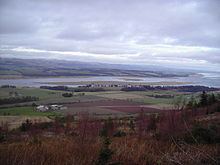 | ||
Mugdrum Island lies in the Firth of Tay, offshore from the town of Newburgh, Fife, in the east of Scotland.
Contents
Map of Mugdrum Island, Newburgh, Cupar, UK
Geography
Mugdrum is low-lying and reedy, with the "North Deep" and "South Deep" channels on either side of the island. It covers an area of 32 acres (130,000 m2).
History
Mugdrum's name is from muc-dhruim, the Scottish Gaelic for hog-back. However, this was applied to the coast opposite, which part it was named for.
The reeds were once harvested for thatching and for protecting potatoes during transshipment. Until 1926, a 50-acre (200,000 m2) farm grew cereals, potatoes and turnips in the island's alluvial soil. It is now a nature reserve under the stewardship of the Tay Valley Wildfowlers' Association.
The Laing Museum in Newburgh preserves the stuffed body of a two-headed kitten born in the 19th century on Mugdrum.