
Country Thailand Time zone THA (UTC+7) Geocode 3501 Province Yasothon Province | Seat Nai Mueang Postal code 35000 Area 578.2 km² | |
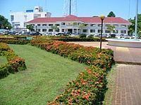 | ||
Mueang Yasothon (Thai: เมืองยโสธร, [mɯ̄a̯ŋ já.sǒː.tʰɔ̄ːn]) is the capital district of the province of Yasothon in northeastern Thailand on the Chi River. Subdistrict Nai Mueang (ในเมือง, in the town) determines the city limits of the town of Yasothon.
Contents
- Map of Mueang Yasothon District Yasothon Thailand
- History
- Geography
- Primary occupations
- Secondary occupations
- Important products
- Administration
- District office
- Education
- Religion
- Military
- References
Map of Mueang Yasothon District, Yasothon, Thailand
History
According to the chronicles of Mueang Yasothon, in 1795 Phra Chao Worawongsa (Phra Wo), Minister of Vientiane, and several others set off to come live with the king in Champassak. Along the way they arrived at a jungle where spirits dwelt, and seeing that it was a good place, they built a village there next to the grounds of an abandoned wat. They called it Wat Singh Tha (วัดสิงห์ท่า), which remains to this day. The village they called Ban Singh Tha (บ้านสิงห์ท่า). Singh is a mythical lion; Tha (ท่า) means pose.
A Fine Arts Dept. marker for a chedi erected by Wat Singh Tha says that, during the Thonburi Era, grandson Kham Su (ท้าวคำสู) called the settlement Ban Singh Thong (บ้านสิงห์ทอง Ban Gold Lion). The wat, which had been deserted with dense jungle blocking the way to the river landing, was re-built and renamed after the new village. The change from Thong (Gold) to Tha (ท่า) was influenced by two factors: Tha means port or landing and also means pose with many connotations. Thus the change in name to Singh Tha means Port Lion, and also Imposing Lion such as those posed on the Lion Gate, and on pedestals on the temple grounds.
In 1814, King Rama II renamed Ban Singh Tha to Yasothon and raised its status to mueang.
Geography
Neighboring districts are (from the north clockwise) Sai Mun, Kut Chum, Pa Tio and Kham Khuean Kaeo of Yasothon Province, Phanom Phrai and Selaphum of Roi Et Province.
Primary occupations
Secondary occupations
Important products
Administration
The district is subdivided into 18 subdistricts (tambon), which are further subdivided into 190 village groups (muban). The town (thesaban mueang) Yasothon covers the whole tambon Nai Mueang. There are further 17 Tambon administrative organizations (TAO).
District office
The Yasothon District Office is located at:
Chaeng Sanit Road
T. Nai Mueang
A. Mueang Yasothon
Yasothon 35000
Education
Private school in Mueang Yasothon:
The secondary schools in Mueang Yasothon are:
College in Mueang Yasothon
Religion
Mueang Yasothon is home to 151 wat, 2 joss houses and 1 mosque, along with 1 school/worship center of the Bahá'í Faith, Roman Catholic, Church of Christ, The Church of Jesus Christ of Latter-day Saints and Jehovah's Witnesses.
Military
Camp Bodindecha (ค่ายบดินทรเดชา) is located west of the city proper in Ban Doet (บ้านเดิด) Tambon Doet, on Route 23 (Chaeng Sanit Road ถนนแจ้งสนิท). The camp has been home to the Royal Thai Army Sixteenth Infantry Regiment (กรมทหารราบที่ ๑๖) since 23 December 1985. The camp also hosts the Bodindecha Golf Club, which is open to the public. 15.907329°N 104.061321°E / 15.907329; 104.061321