
Country Thailand Time zone THA (UTC+7) Geocode 3301 Population 135,512 (2009) | Seat Mueang Nuea Postal code 33000 Area 576.4 km² Province Sisaket Province | |
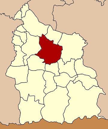 | ||
Mueang Sisaket (Thai: เมืองศรีสะเกษ, rtgs: Mueang Si Sa Ket) is the capital district (Amphoe Mueang) of Sisaket Province, northeastern Thailand.
Contents
Map of Mueang Si Sa Ket District, Sisaket, Thailand
Etymology
Thai honorific Si is derived from the Sanskrit title of veneration Sri; Sisaket is sometimes transliterated as Srisaket, Sri Saket, Si Saket or Si Sa Ket.
History
The district was renamed from Klang Si Sa Ket (กลางศีร์ษะเกษ) to Mueang Sisaket in 1913. 1917 the Mueang was removed from the name, which was added again in 1938.
Geography
Neighboring districts are (from the north clockwise) Yang Chum Noi, Kanthararom, Nam Kliang, Phayu, Wang Hin, Uthumphon Phisai and Rasi Salai.
Administration
The district is subdivided into 18 subdistricts (tambon), which are further subdivided into 166 villages (muban). The town (thesaban mueang) Sisaket covers the tambon Mueang Nuea and Mueang Tai and parts of tambon Nong Khrok, Phon Kha, Ya Plong and Pho. Nam Kham is a subdistrict municipality (thesaban tambon) which covers the whole same-named subdistrict. There are further 15 Tambon administrative organizations (TAO).
Missing numbers are tambon which now form the districts Wang Hin and Phayu.