
Country Thailand Time zone THA (UTC+7) Geocode 5213 Population 34,494 (2005) | Seat Mueang Pan Postal code 52240 Area 865.1 km² Province Lampang Province | |
 | ||
Mueang Pan (Thai: เมืองปาน; [mɯ̄aŋ pāːn]) is a district (amphoe) in the northern part of Lampang Province, northern Thailand.
Contents
Map of Mueang Pan District, Lampang, Thailand
Geography
Neighboring districts are (from the north clockwise) Wiang Pa Pao of Chiang Rai Province, Wang Nuea, Chae Hom and Mueang Lampang of Lampang Province, and Mae On and Doi Saket of Chiang Mai Province.
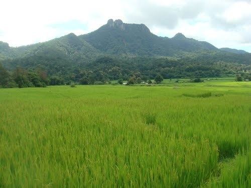
The Phi Pan Nam Mountains dominate the landscape of the district.
History
The minor district (King Amphoe) Mueang Pan was established on July 15, 1981, when the four tambon Mueang Pan, Chae Son, Ban Kho and Thung Kwao were split off from Chae Hom. On May 9, 1992 it was upgraded to a full district.
Administration
The district is subdivided into 5 subdistricts (tambon), which are further subdivided into 53 villages (muban). There are no municipal (thesaban) areas, and 5 Tambon administrative organizations (TAO).