
Country Thailand - Tambon 25 Time zone THA (UTC+7) | - Established AD.1895 - Muban 243 Area 755.6 km² | |
 | ||
- Local Admin. 10 Municipality,17 SAO. Province Nakhon Ratchasima Province | ||
Mueang Nakhon Ratchasima (Thai: อำเภอเมืองนครราชสีมา) (amphoe mueang) is one of 32 districts of Nakhon Ratchasima Province, Northeastern Thailand. Including the center city of district is City of Nakhon Ratchasima.
Contents
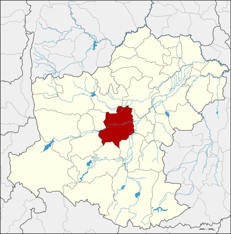
- Map of Mueang Nakhon Ratchasima District Nakhon Ratchasima Thailand
- Introduction
- Geography
- Car
- Bus
- Train
- Administration
- References
Map of Mueang Nakhon Ratchasima District, Nakhon Ratchasima, Thailand
Introduction
Mueang Nakhon Ratchasima is an ancient city. The present city was built in the reign of King Narai the Great of Ayutthaya kingdom. The king merged the two ancient cities, Mueang Sema and Mueang Khorakha Pura (Khorat) and moved to the present area. He named the new city Nakhon Ratchasima and set it as the eastern frontier city of Ayutthaya. The landscape and city planning of Nakhon Ratchasima city designed by French architect.
The city of various Khmer ruins and the famous statute of Khun Ying Mo named Nakhon Ratchasima or commonly known as "Khorat" is situated on Khorat plateau, the lower part of Northeastern plateau of Thailand. The city itself serves as the gateway to the Northeastern Region. From Bangkok, it is 259 km. by car and 264 km by train. It has an area of 755.60 km² or about 468,704 rai (185,311 acre) with a residential registration population of 433,838 inhabitants(2008 census).
Geography
Neighboring districts are (from the north clockwise) Non Thai, Non Sung, Chaloem Phra Kiat, Chok Chai, Pak Thong Chai, Sung Noen and Kham Thale So.
The main river through the district is the Lam Takhong.
Car
Travelling by car from Bangkok to Nakhon Ratchasima is most convenient, there are three alternative routes to choose depending on the starting point in Bangkok.
Bus
There are several air-conditioned (Coach Standard-1 and 2) buses leaving from the Northeastern Bus Terminal (Kampaeng Phet 2 Road) to Nakhon Ratchasima Bus Terminal 1 (Burin Rd.) and 2 (Mittraphap Rd.) with 3 service agencies; Air Korat Pattana, Ratchasima Tour and Suranaree Air. Air-conditioned buses leave every 20 minutes throughout 24 hours.
Train
There are several trains leaving Bangkok Railway Station (Hua Lampong) daily to the two major train stations (Nakhon Ratchasima and Thanon Chira train stations) in the city.
Administration
The district is subdivided into 25 subdistricts (tambon) with 27 local administration.
There are contains 10 municipalities, which 1 city municipality (thesaban nakhon) - City of Nakhon Ratchasima or Korat City covers the whole area of Nai Mueang subdistrict (tambon) and parts of Ban Ko subdistrict, the 9 township municipalities (thesaban tambon) - Pho Klang covers whole area of Pho Klang subdistrict, Hua Thale covers whole area of Hua Tale subdistrict, Nong Phai Lom covers whole area of Nong Phai Lom subdistrict, Cho Ho covers parts of Cho Ho subdistricts and parts of Ban Ko subdistrict, Khok Sung covers whole area of Khok Sung subdsitrict, Pru Yai covers whole area of Pru Yai subdistrict, Khok Kruat & Mueang Mai Khok Kruat covers of Khok Kruat subdistrict, Nong Khai Nam covers whole area of Nong Khai Nam subdistrict.
And 17 Subdistrict Administrative Organization (SAO) - Ban Ko, Ban Mai, Ban Pho, Chai Mongkhon, Cho Ho, Maroeng, Muen Wai, Nong Bua Sala, Nong Chabok, Nong Krathum, Nong Rawiang, Phanao, Phon Krang, Phutsa, Si Num, Suranaree and Talat responsible for the non-municipal areas.