
Country Thailand Time zone ICT (UTC+7) Geocode 5801 Population 53,333 (2010) | Seat Chong Kham Postal code 58000 Area 2,483 km² Province Mae Hong Son Province | |
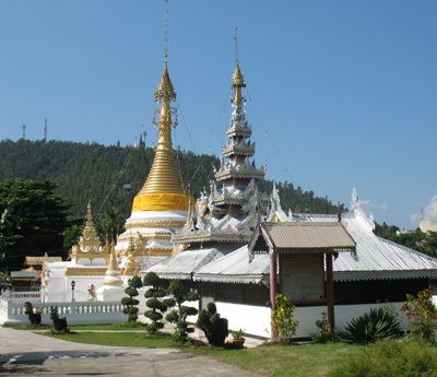 | ||
Mueang Mae Hong Son (Thai: เมืองแม่ฮ่องสอน, [mɯ̄a̯ŋ mɛ̂ː hɔ̂ŋ sɔ̌ːn]) is the capital district (amphoe mueang) of Mae Hong Son Province, northern Thailand.
Contents
- Map of Mueang Mae Hong Son District Mae Hong Son 58000 Thailand
- History
- Geography
- Administration
- References
Map of Mueang Mae Hong Son District, Mae Hong Son 58000, Thailand
History
The Interior Ministry upgraded Mueang Mae Hong Son to a fourth-class city under Monthon Phayap on 10 May 1910. It then consisted of the four districts: Mueang Mae Hong Son, Mueang Yuam (now Mae Sariang District), Pai, and Khun Yuam.
In 1917, the district was renamed from Mueang to Muai To (ม่อยต่อ). In 1938 it was renamed Mueang Mae Hong Son. The northeastern part of the district was split off in 1987 and formed the new district Pang Mapha.
Geography
The Daen Lao Range dominates the landscape of this district. Neighboring districts are (from south clockwise) Khun Yuam of Mae Hong Son Province, Kayah State of Myanmar, Pang Mapha, Pai of Mae Hong Son Province and Galyani Vadhana and Mae Chaem of Chiang Mai Province.
The Namtok Mae Surin National Park office is in the district.
Administration
The district is divided into seven sub-districts (tambon), which are further subdivided into 70 villages (muban). Mae Hong Son itself is a town (thesaban mueang) which covers the complete tambon Chong Kham. Each of the other six tambon is administrated by a tambon administrative organization (TAO).
Missing numbers are tambon which now form Pang Mapha District.