
Country Thailand Time zone THA (UTC+7) Geocode 1601 Population 247,842 (2007) | Seat Thale Chup Son Postal code 15000 Area 565.6 km² Province Lopburi Province | |
 | ||
Mueang Lopburi (Thai: เมืองลพบุรี, rtgs: Mueang Lop Buri, [mɯ̄a̯ŋ lóp bū.rīː]) is the capital district (Amphoe Mueang) of Lopburi Province, central Thailand.
Contents
- Map of Mueang Lop Buri District Lopburi Thailand
- History
- Geography
- Administration
- Transportation
- References
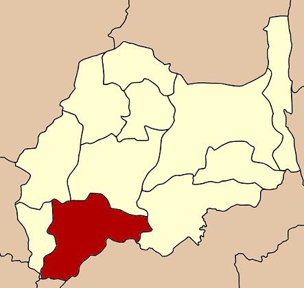
Map of Mueang Lop Buri District, Lopburi, Thailand
History
Lopburi is an ancient city. In Khmer era, it was Lavo or Lava Pura, the important city of the eastern part of Chao Phraya river valley. In Ayuthaya kingdom, it was the northeastern frontier city. The glorious period of Lopburi was during the reign of King Narai the Great. He stayed in his palace 8–9 months a year, making Lopburi was the 2nd capital of the kingdom. After his reign, the city became nearly deserted, only to be enriched again when King Mongkut visited and renovated King Narai's Palace.
Field Marshal Plaek Phibunsongkhram set up Lopburi as the military center of Thailand. He relandscaped the Lopburi city, with its modern center located about 4 km east from the historical center. His building style, Art Deco is showing along Narai Maharat road.
Geography
The southwestern part of the district is very low alluvial plain. The rest is intermixed between plains and hills. Beside the Lopburi River, the important water resource are the Sap Lek Reservoir and Khlong Raphiphat. Neighboring districts are (from the west clockwise) Tha Wung, Ban Mi, Khok Samrong and Phatthana Nikhom of Lopburi Province, Phra Phutthabat, Nong Don and Don Phut of Saraburi Province, Ban Phraek of Ayutthaya Province, and Chaiyo of Ang Thong Province.
Administration
The district is subdivided into 24 subdistricts (tambon), which are further subdivided into 223 villages (muban). The town (thesaban mueang) Lopburi covers the complete tambon Tha Hin and parts of Thale Chup Son. There are two further subdistrict municipalities (thesaban tambon) - Khao Phra Ngam covering the complete tambon Khao Phra Ngam, and Khok Tum covering the tambon Khok Tum and Nikhom Sang Ton Eng. There are further 19 Tambon administrative organizations (TAO).
Geocode 13 not used.
Transportation
The district is served by: