
Country Thailand Time zone THA (UTC+7) Geocode 3318 Population 17,861 (2005) | Seat Mueang Chan Postal code 33120 Area 95.83 km² Province Sisaket Province | |
 | ||
Mueang Chan (Thai: เมืองจันทร์) is a district (Amphoe) of Sisaket Province, northeastern Thailand.
Contents
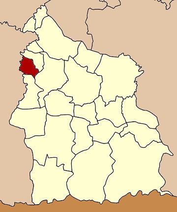
Map of Mueang Chan District, Sisaket, Thailand
History
The minor district (King Amphoe) was created on April 1, 1992, when three tambon were split off from Uthumphon Phisai district. It was upgraded to a full district on October 11, 1997.
Geography
Neighboring districts are (from the north clockwise) Pho Si Suwan, Uthumphon Phisai, Huai Thap Than of Sisaket Province, Samrong Thap, Non Narai and Rattanaburi of Surin Province.
Administration
The district is subdivided into 3 subdistricts (tambon), which are further subdivided into 52 villages (muban). There are no municipal (thesaban) areas, and 3 Tambon administrative organizations (TAO).
References
Mueang Chan District Wikipedia(Text) CC BY-SA