
Country Thailand Time zone ICT (UTC+7) Geocode 3801 Population 89,978 (2012) | Seat Bueng Kan Postal code 38000 Area 791.9 km² Province Bueng Kan Province | |
 | ||
Mueang Bueng Kan (Thai: เมืองบึงกาฬ; [mɯ̄aŋ bɯ̄ŋ kāːn]) is a capital district (amphoe mueang) of Bueng Kan Province, northeastern Thailand. It is 759 km north-northwest of Bangkok.
Contents
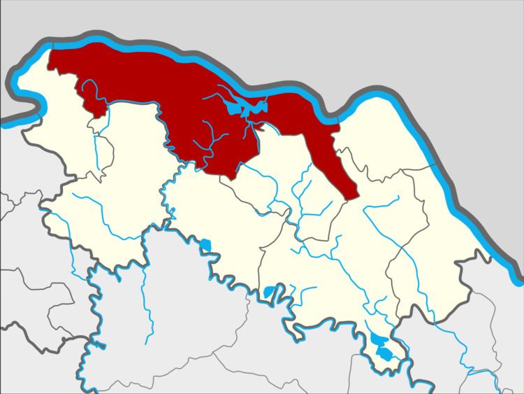
- Map of Mueang Bueng Kan District Bueng Kan 38000 Thailand
- History
- Etymology
- Geography
- Administration
- References
Map of Mueang Bueng Kan District, Bueng Kan 38000, Thailand
History
The district was originally named Chai Buri (ไชยบุรี) and was a part of Nakhon Phanom Province. In 1917 it was reassigned to Nong Khai, and 1939 it was renamed Bueng Kan.
On 3 August 2010, the proposal of separating Bueng Kan Province from Nong Khai Province was approved by Thai government. As of 22 March 2011, the "Act Establishing Changwat Bueng Kan, BE 2554 (2011)" has been published in the Government Gazette. The district became the capital district (amphoe mueang) of the new province, and therefore renamed to Amphoe Mueang Bueng Kan by section 4 of the Act.
On occasions during its history, especially during the 1970s and 1980s, there have been some conflicts with Lao people on the border. On 23 April 1975, the people's armed forces in Bueng Kan destroyed an enemy stronghold, killing 12 and Thai authorities reportedly admitted that 17 were killed eventually out of about 50. In the early 1980s two patrol boats of the Thai KPL reportedly opened fire and two Lao soldiers were arrested in Bueng Kan.
Etymology
Bueng (TH: บึง) means "swamp" or "marsh". Kan (TH: กาฬ) is Thai for the Hindu goddess Kali; as an adjective it may mean "black" and as a noun, "black mark of death."
Geography
Neighboring districts are (from the east clockwise) Bung Khla, Seka, Si Wilai, Phon Charoen, So Phisai, and Pak Khat of Bueng Kan Province. To the north across the Mekong river is the Laotian province Bolikhamxai.
Administration
The district is subdivided into 12 subdistricts (tambon), which are further subdivided into 131 villages (muban). Bueng Kan is a subdistrict municipality (thesaban tambon) which covers parts of tambon Bueng Kan and Wisit. The remaining area of Wisit subdistrict belongs to the subdistrict municipality Wisit. Non Kheng, Ho Kham, Khok Kong and Khai Si are subdistrict municipalities each covering the whole same-named subdistrict. There are further 7 tambon administrative organizations (TAO) for those subdistricts not covered by municipalities.
Missing numbers are tambon which now form the districts Bung Khla and Si Wilai.