
Norse name Rauðøy Mikla OS grid reference HU317650 Highest elevation 172 m Year first constructed 1897 (first) | Meaning of name big red island Area rank 37 Area 17.73 km² | |
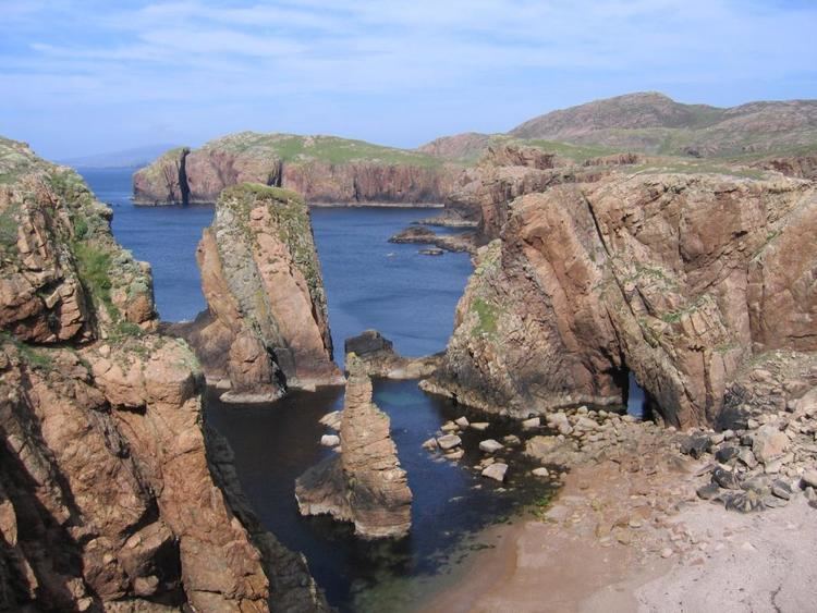 | ||
Watching from top of north ham muckle roe shetland
Muckle Roe is an island in Shetland, Scotland, in St. Magnus Bay, to the west of Mainland, Shetland. It has a population of around 130 people, who mainly croft and live in the south east of the island.
Contents
- Watching from top of north ham muckle roe shetland
- Map of Muckle Roe Shetland UK
- Waves at the hams of muckle roe
- History
- Geography and geology
- References
Map of Muckle Roe, Shetland, UK
Waves at the hams of muckle roe
History
The island is referred to in the Orkneyinga saga.
In 1905 a bridge was built between Muckle Roe and the Shetland Mainland over Roe Sound at a cost of £1,020 met from public subscription and a grant from the Congested Districts Board. The construction was of iron and concrete and its completion was followed by a reversal in the population decline seen in the 19th and earlier 20th centuries. A replacement bridge was built in 1999.
Geography and geology
Muckle Roe is approximately 3 miles (4.8 km) in diameter, with high cliffs in the south. Its highest point is Mid Ward 172 metres (564 ft).
The island's rock is red granite, which gives the island its name – a combination of Scots and Old Norse meaning "big red island".
There are crofts in the east and south east. The rest of the island is lochan-studded moorland.