Harman Patil (Editor)

MountainsMap

Updated on
Edit
Like
Comment
Share on FacebookTweet on TwitterShare on LinkedInShare on Reddit
Developer(s)
  
Digital Surf

Operating system
  
Windows

Type
  
Scientific Software

Initial release
  
September 1996

Platform
  
PC

MountainsMap

Stable release
  
7.3 / January 25, 2016 (2016-01-25)

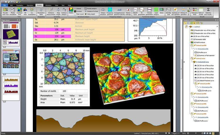
MountainsMap is a surface imaging and metrology software published by the company Digital Surf. Its main application is micro-topography, the science of studying surface texture and form in 3D at the microscopic scale. The software is used mainly with stylus-based or optical profilometers, optical microscopes and scanning probe microscopes.

Contents

Since version 7.0, MountainsMap includes a version dedicated to scanning electron microscopes, with 3D reconstruction, and one to hyperspectral microscopes and cameras (Raman, FT-IR, EELS, EDX hyperspectral cube analysis).

MountainsMap is mainly offered as embedded or optional OEM analysis software by most profilometer and microscope manufacturers, usually under their respective brands; it is sold for instance as:

  • TalyMap, TalyProfile, or TalyMap Contour on Taylor-Hobson's profilometers,
  • PicoImage on Agilent's AFM's,
  • HommelMap on Jenoptik's profilometers (Hommel-Etamic line of products),
  • MountainsMap - X on Nikon's microscopes,
  • Apex 2D or Apex 3D on KLA-Tencor's profilometers,
  • Leica Map on Leica's microscopes,
  • ConfoMap on Carl Zeiss' microscopes,
  • MCubeMap on Mitutoyo profilometers.
  • Vision 64 Map on Bruker optical profilometers
  • MountainsMap is available in English, Brazilian Portuguese, simplified Chinese, French, German, Italian, Japanese, Korean, Polish and Spanish.

    Compatibility

  • MountainsMap's native file format is the SURF format (.SUR extension).
  • it is compatible with most instruments of the market capable of supplying images or topography.
  • MountainsMap complies to the ISO 25178 standard on 3D surface texture evaluation and offers the profile and areal filters defined in ISO 16610.
  • Generated metrology reports are generated in proprietary format but can be exported to PDF and RTF formats.
  • History of versions

  • Digital Surf launched their first (2D) surface analysis software package in 1990 for MS-DOS ("DigiProfil 1.0"), then their first 3D surface analysis package in 1991 for Macintosh II ("DigiSurface 1.0").
  • Version 1.0 of MountainsMap was launched in September 1996, introducing a change in the name after a move of the editor to Windows from MsDos and Macintosh platforms.
  • Version 5.0 introduced the management of multi-layers images. It was a move to Confocal microscopy (analysis of topography+color as a single object as opposed to separate objects in former versions), and to SPM image analysis (analysis of topography+current, topography+phase, topography+force as a single image).
  • Version 6.0 completed the specialization of the platform per instrument type. For Version 6.0 the company teamed with a group of alpinists to launch the new version at the summit of the Makalu mountain. A special logo was created for this marketing event. The expedition was successful and Alexia Zuberer, a French and Swiss mountaineer was then the first Swiss woman to reach the summit of the Makalu, Sandrine de Choudens, a French PhD in chemistry being the first French woman to succeed
  • Version 7.0 was unveiled in September 2012 at the European Microscopy Congress in Manchester, UK. It expanded the list of instruments supported, in particular with new Scanning electron microscope 3D reconstruction software and hyperspectral data analysis (such as Raman and FT-IR hyperspectral cube analysis).
  • Version 7.2 (February 2015) introduces near real-time 3D topography reconstruction for scanning electron microscopes
  • Version 7.3 (January 2016) adds fast colorization of scanning electron microscope images based on object-oriented image segmentation.
  • References

    MountainsMap Wikipedia