
Basin countries United States Surface elevation 1,538 m Length 8 km Cities Westwood | Primary outflows Hamilton Creek Max. length 5 miles (8.0 km) Area 23.47 km² Width 3.2 km | |
 | ||
Catchment area 163.1 square miles (422 km) | ||
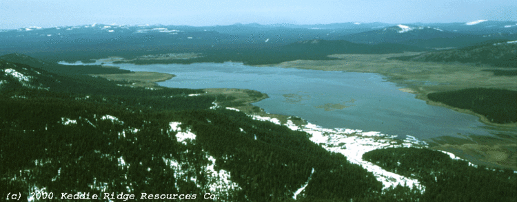
Mountain meadows reservoir drone view
Mountain Meadows Reservoir is an artificial lake, located in Lassen County, California. The lake is also known as Walker Lake. Its waters are impounded by the Indian Ole Dam, which was completed in 1924.
Contents
- Mountain meadows reservoir drone view
- Map of Mountain Meadows Reservoir California USA
- Nordic ice skating on mountain meadows reservoir
- HydrologyEdit
- Indian Ole DamEdit
- HistoryEdit
- RecreationEdit
- References
Map of Mountain Meadows Reservoir, California, USA
Nordic ice skating on mountain meadows reservoir
HydrologyEdit
The lake is fed by Robbers Creek, Goodrich Creek, Duffy Creek, Cottonwood Creek, Mountain Meadows Creek, Greenville Creek, and Deerheart Creek. It discharges into Hamilton Creek, which feeds Lake Almanor.
Indian Ole DamEdit
Indian Ole Dam is a flashboard and buttress dam, it is 264 feet (80 m) long and 26 feet (7.9 m) high, with 8 feet (2.4 m) of freeboard. Pacific Gas and Electric Company owns the dam and manages the surrounding lands.
HistoryEdit
Cultural remnants of both the American pioneers and the Maidu exist near the reservoir and other sites are believed to exist beneath its waters.
As of September 13, 2015, the reservoir was completely dry, resulting in the death of perhaps thousands of fish.
RecreationEdit
Recreational uses of the lake include duck hunting, bird watching, fishing, and ice-skating. Near the dam there is a boat ramp, which is accessible by way of a County-maintained gravel road.