
Prominence 61 m | Elevation 1,152 m | |
 | ||
Listing #92 New England 100 Highest Easiest route maintained hiking trail Similar Bread Loaf Mountain, Dorset Mountain, Mendon Peak, Big Jay, Pico Peak | ||
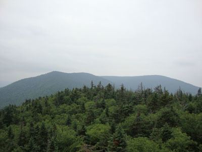
Mount Wilson is a mountain located in Addison County, Vermont, in the Green Mountain National Forest. The mountain is part of the central Green Mountains. Mount Wilson is flanked to the southwest by Bread Loaf Mountain.
Map of Mt Wilson, Ripton, VT 05766, USA
The southeast side of Mount Wilson drains into the headwaters of the White River, thence into the Connecticut River which drains into Long Island Sound in Connecticut. The northeast end of Mt. Wilson drains into Clark Brook, thence into the White River. The northwest side of Mt. Wilson drains into the headwaters of the New Haven River, thence into Otter Creek, Lake Champlain, Canada's Richelieu River, the Saint Lawrence River, and ultimately into the Gulf of Saint Lawrence.
The Long Trail, a 272-mile (438 km) hiking trail running the length of Vermont, traverses the summit ridge of Mt. Wilson.