
Elevation 2,841 m Prominence 651 m Easiest route Climbing | First ascent 1923 | |
 | ||
Similar Mount Gould, Mount Grinnell, Iceberg Peak, Allen Mountain, Mount Merritt | ||
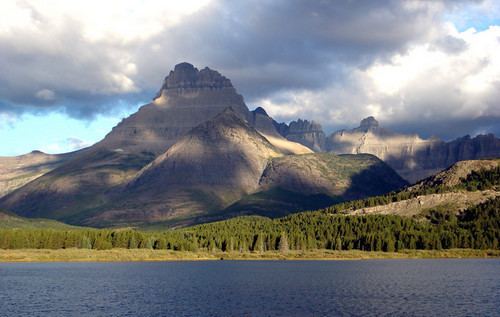
Mount Wilbur (9,326 feet (2,843 m)) is located in the Lewis Range, Glacier National Park in the U.S. state of Montana. Plainly visible from the region of Many Glacier, the peak rises over 4,500 feet (1,372 m) above Swiftcurrent Lake and is a steep pyramid on three sides. The west slopes of the peak join to ridges along the continental divide. Much of the climbing routes are rated at class 4 to 5, with some only used once. The sedimentary rock of the mountains makes for often poor anchoring points and enhances the difficulty. A cirque on the north slopes of the mountain shelter Iceberg Lake, a popular hiking destination from Many Glacier.
Map of Mt Wilbur, Montana 59417, USA
References
Mount Wilbur (Montana) Wikipedia(Text) CC BY-SA