
Pronunciation [tsuɽumidake] Mountain type Lava dome Elevation 1,374 m | Last eruption March to May 867 CE | |
 | ||
Topo map Geographical Survey Institute 25000:1 別府東 Similar Mount Yufu, Garandake, Takasakiyama, Mt Kuzumi, Mt Taisen | ||
Exchange in japan 9 climbing mount tsurumi
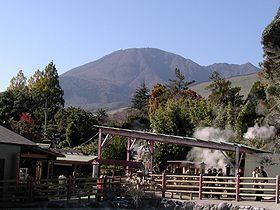
Mount Tsurumi (鶴見岳, Tsurumi-dake) is a 1,374.5 m (4,510 ft) volcano in Beppu, Ōita, Japan.
Contents
- Exchange in japan 9 climbing mount tsurumi
- Map of Mount Tsurumi Higashiyama Beppu Oita Prefecture 874 0000 Japan
- Mount tsurumi 11 febuary 2014
- Outline
- Route
- Access
- References
Map of Mount Tsurumi, Higashiyama, Beppu, Oita Prefecture 874-0000, Japan
Mount tsurumi 11 febuary 2014
Outline
Mount Tsurumi is a lava dome. It has several peaks, including, Mount Kuranoto, Mount Uchi, Mount Garan. This mountain is one of Japan 300 mountains, and a part of Aso Kujū National Park.
Route
The easiest way to reach to the top of Mount Tsurumi is to use Kintetsu Beppu Ropeway. When walking up to the top, it takes about two hours from Toriimae Bus Stop and two and half hours from Higashi Tozanguchi Bus Stop.
Access
References
Mount Tsurumi Wikipedia(Text) CC BY-SA