
Topo map USGS Los Gatos Prominence 92 m | Elevation 1,060 m | |
 | ||
Similar Mount Bielawski, Mount Umunhum, Mount Sizer, Black Mountain, Montara Mountain | ||
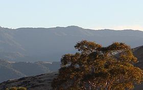
Mount Thayer is a mountain in the Santa Cruz mountain range located in Santa Clara County, California. The summit is in a section of the abandoned Almaden Air Force Station, about 1 mile west of Mount Umunhum. The elevation of the summit is at 3,479 feet (1,060 m) feet. An old derelict building, surrounded by telephone poles, is located on the summit. Mount Thayer, along with the surrounding property is off limits to the public.
Map of Mt Thayer, California 95033, USA
References
Mount Thayer Wikipedia(Text) CC BY-SA