
Topo map USGS Gladstone Last eruption 500,000 years ago | Prominence 125 m Parent range Cascade Range | |
 | ||
Elevation 740+ ft (226+ m) NGVD 29 Similar Pilot Butte, Rocky Butte, Mount Tabor, Mount Scott, Steens Mountain | ||
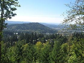
Mount Talbert is an volcanic cinder cone in Clackamas County, Oregon. It is part of the Boring Lava Field, a zone of ancient volcanic activity in the area around Portland. Its summit rises to an elevation of 740+ feet (226+ m).
Map of Mount Talbert, Sunnyside, OR 97015, USA
The butte remains undeveloped and is the location of a nature park of the same name which is managed by North Clackamas Parks and Recreation. The park has several interlinked hiking trails, along which there are several interpretive signs about the area's natural resources.
References
Mount Talbert Wikipedia(Text) CC BY-SA