
Parent range Daiko Mountains | Elevation 1,248 m | |
 | ||
Similar Mt Miune, Mount Ōdaigahara, Mt Kuroso, Mount Kongō, Mount Ōmine | ||
20140112
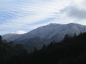
Mount Takami (高見山, Takami-san/Takami-yama) is a 1,248.3 m (4,095 ft) mountain of Daiko Mountains, which is located on the border of Higashiyoshino, Nara, and Matsusaka, Mie, Japan
Contents
- 20140112
- Map of Mount Takami Hirano Higashiyoshino Yoshino District Nara Prefecture 633 2303 Japan
- Outline
- Routes
- References
Map of Mount Takami, Hirano, Higashiyoshino, Yoshino District, Nara Prefecture 633-2303, Japan
Outline
This mountain is located on the north end of Daiko Mountains. This mountain is one of the 300 Famous Japanese Mountains. This mountain is an important part of Muro-Akame-Aoyama Quasi National Park.
Routes
This mountain is very famous for the beautiful frost patterns that form on trees in winter and so attract many climbers. There are several routes to reach the top; one is from Takami-Otoge Pass and it takes about one hour; another route is from Takami-tozanguchi Bus Stop on the Nara Kotsu bus route, and it takes two and a half hours. The third route is from Shimo-Hirano Bus stop, also on the Nara Kotsu bus route, and it also takes two and a half hours.