
Elevation 584 m | Easiest route Bitumen road. | |
 | ||
Similar Mount Blackwood, Mount Fox, Mount Bowen, Mount Bellenden Ker, Mount Bartle Frere | ||
.
Map of Mount Stuart, QLD 4811, Australia
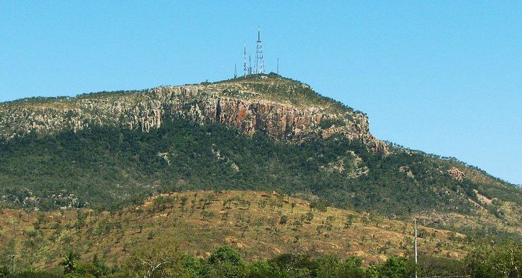
Mount Stuart is located in Queensland, Australia, overlooking Townsville with an elevation of 584 metres.
It was named for Clarendon Stuart (1833–1912), from 1859 Townsville's first district surveyor.
Mount Stuart is used for commercial and ABC Queensland television transmission, it was also used as a Bureau of Meteorology radar station until late 2011, where it was moved to Hervey Range.
Mount Stuart overlooks Townsville's Lavarack Barracks a major military base, which consists of 1 RAR, 2 RAR, 3 RAR, 2 CAV, 3/4 CAV, 3 CER, 1 MP Bn, 3 CSSB amongst others.
Mount Stuart is a popular outdoor recreational area, including trail running, mountain biking and rock climbing. Mount Stuart climbing guide
References
Mount Stuart, Queensland Wikipedia(Text) CC BY-SA