
 | ||
Similar Ein Gedi, Masada, Nachal Arugot, Wadi Sdeir, Dead Sea | ||
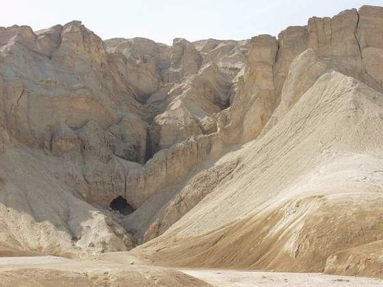
the dead sea mount sodom
Mount Sodom (Hebrew: הר סדום, Har Sedom) or Jebel Usdum (Arabic: جبل السدوم, Jabal(u) 'ssudūm) is a hill along the southwestern part of the Dead Sea in Israel, part of the Judean Desert Nature Reserve.
Contents
- the dead sea mount sodom
- Map of Mount Sodom
- An underground adventure in a salt cave at mount sodom
- History
- References
Map of Mount Sodom
An underground adventure in a salt cave at mount sodom
History
Mount Sodom began its rise hundreds of thousands of years ago and continues to grow taller at a rate of 3.5 millimetres (0.14 in) a year.
Movements of the African rift system, along with the pressure generated by the slow accumulation of earth and rock, pressed down on the layers of salt, creating Mount Sodom. It is about 80 percent salt, 720 feet (220 m) high, capped by a layer of limestone, clay and conglomerate that was dragged along as it was squeezed up from the valley floor.
It is approximately 8 kilometres (5 mi) long, 5 kilometres (3 mi) wide, and 226 metres (742 ft) above the Dead Sea water level, yet 170 metres (557 ft) below world mean sea level. Because of weathering, some portions have separated. One of these pillars is known as "Lot's wife", in reference to the Biblical account of the destruction of Sodom and Gomorrah.