
Topo map USGS Circle B-5 Prominence 849 m | Elevation 1,611 m | |
 | ||
Similar Buldir Volcano, Mount Igikpak, Korovin Volcano, Mount Chiginagak, Mount Griggs | ||
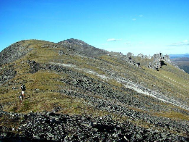
Mount Prindle is a granitic mountain in the Yukon-Tanana Uplands, and is located approximately 45 miles (72 km) north-northeast of Fairbanks, Alaska. The plutons that form the core of the Mount Prindle massif are Late Cretaceous or early Tertiary age. These plutons intruded older (Precambrian to Paleozoic) metamorphic rocks. Mount Prindle exhibits classic glacial landforms, unlike most of the surrounding Yukon-Tanana Uplands. It is in the Circle Mining District and many of the surrounding creeks have been or are being mined for placer gold. The area has also been prospected for tin and rare earth minerals. Mine roads and hiking trails provide access to the mountain. A 900 feet (270 m) granite wall on an eastern spur of the massif is an attraction for rock climbers.
Map of Mt Prindle, Alaska 99730, USA
The mountain is named for Louis Marcus Prindle (1865–1956), a U.S. Geological Survey geologist, who worked in the Fairbanks, Circle, and Fortymile areas of Alaska from 1902 through 1911.