
Isolation 21.50 mi (34.60 km) Prominence 914 m | Elevation 4,141 m | |
 | ||
Listing North America highest peaks 88thUS highest major peaks 71stColorado highest major peaks 36th Topo map USGS 7.5' topographic mapMount Powell, Colorado Similar West Buffalo Peak, Jacque Peak, Mount Herard, Hagues Peak, Vermilion Peak | ||
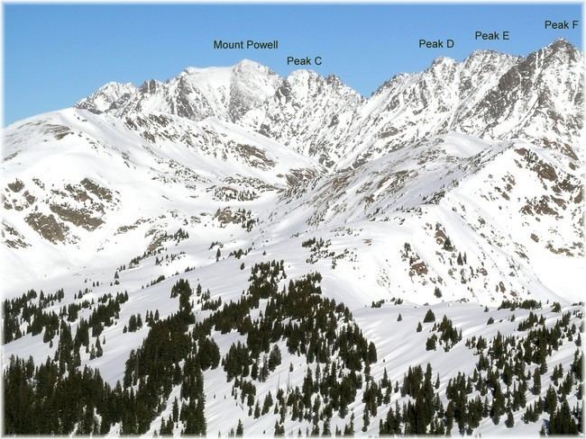
Mount Powell is the highest summit of the Gore Range in the Rocky Mountains of North America. The prominent 13,586-foot (4,141 m) thirteener is located in the Eagles Nest Wilderness, 8.5 miles (13.7 km) north by east (bearing 8°) of the Town of Vail, Colorado, United States, along the drainage divide separating White River National Forest and Eagle County from Arapaho National Forest and Summit County. Mount Powell was named in honor of John Wesley Powell who climbed to the summit in 1868.
Contents
Map of Mount Powell, Colorado 80498, USA
MountainEdit
Mount Powell is very prominent when viewed from the north east, rising 6,000 feet above Green Mountain Reservoir.
References
Mount Powell (Colorado) Wikipedia(Text) CC BY-SA