
 | ||
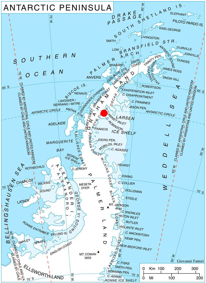
Mount Popov (Bulgarian: Попов връх, ‘Popov Vrah’ po-'pov 'vr&h) is the broad ice-covered peak with precipitous rocky slopes rising to 650 m in eastern Bigla Ridge on Heros Peninsula, Foyn Coast on the Antarctic Peninsula. It surmounts Beaglehole Glacier to the west and Cabinet Inlet to the northeast.
Contents
Map of Mount Popov, Antarctica
The feature is named after Todor Popov, physician at St. Kliment Ohridski Base during the 1996/97 and 1997/98 seasons.
Location
Mount Popov is located at 66°32′20″S 63°54′25″W, which is 13 km south-southwest of Balder Point, 7.65 km northwest of Spur Point and 12.64 km northeast of Varad Point. British mapping in 1974.
Maps
References
Mount Popov Wikipedia(Text) CC BY-SA