
- land 1.1 km (0 sq mi) - summer (DST) EDT (UTC-4) Local time Monday 1:34 AM | - water 0.0 km (0 sq mi) Area 110 ha Population 3,175 (2013) | |
 | ||
Weather 3°C, Wind W at 5 km/h, 69% Humidity | ||
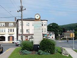
Mount Penn is a borough in Berks County, Pennsylvania, United States. The population was 3,106 at the 2010 census. The borough shares a name with a 1,120-foot-high (340 m) mountain that rises to the north and overlooks the city of Reading. The peak is sometimes recognized as the southern end of the Reading Prong group of mountains.
Contents
Map of Mt Penn, PA 19606, USA
Geography
Mount Penn Borough is located in central Berks County at 40°19′46″N 75°53′26″W (40.329359, -75.890691), bordered by the city of Reading to the west. The borough of St. Lawrence borders Mount Penn to the east. The unincorporated community of Pennside lies to the north in Lower Alsace Township. A non-contiguous piece of Lower Alsace Township also borders the south side of Mount Penn.
The borough is in a small saddle between the peak of Mount Penn to the north and 900-foot-high (270 m) Neversink Mountain to the south.
According to the United States Census Bureau, the borough has a total area of 0.42 square miles (1.1 km2), all of it land.
The Mount Penn reserve is a Reading city park that covers the Mount Penn slopes north of the borough. Attractions in the reserve include the Pagoda and the Fire Tower.
Demographics
As of the census of 2000, there were 3,016 people, 1,278 households, and 829 families residing in the borough. The population density was 7,076.8 people per square mile (2,708.1/km²). There were 1,335 housing units at an average density of 3,132.5 per square mile (1,198.7/km²). The racial makeup of the borough was 96.45% White, 1.06% African American, 0.03% Native American, 1.06% Asian, 0.50% from other races, and 0.90% from two or more races. Hispanic or Latino of any race were 3.38% of the population.
There were 1,278 households, out of which 30.2% had children under the age of 18 living with them, 50.4% were married couples living together, 11.2% had a female householder with no husband present, and 35.1% were non-families. 29.6% of all households were made up of individuals, and 13.7% had someone living alone who was 65 years of age or older. The average household size was 2.35 and the average family size was 2.93.
In the borough the population was spread out, with 24.5% under the age of 18, 6.8% from 18 to 24, 30.7% from 25 to 44, 21.6% from 45 to 64, and 16.3% who were 65 years of age or older. The median age was 37 years. For every 100 females there were 91.6 males. For every 100 females age 18 and over, there were 85.9 males.
The median income for a household in the borough was $41,326, and the median income for a family was $47,917. Males had a median income of $40,603 versus $26,890 for females. The per capita income for the borough was $21,738. About 2.4% of families and 4.4% of the population were below the poverty line, including 4.8% of those under age 18 and 9.5% of those age 65 or over.
Government
Mount Penn is governed by an elected mayor and seven-member Borough Council. The current mayor is Benjamin Dennis Overley Sr. The members of council are Thomas Staron, Kurt Miller, Mike Worrall, Mark Dudash, Claudia Hurwitz, Roger Reto, and Christin Reeser.
Transportation
U.S. Route 422 Business (Perkiomen Avenue) runs through the center of the borough, leading west into downtown Reading and southeast to Pottstown.